IMAGES TAKEN NEAR TO
Elms Vale Road, DOVER, CT17 9PJ
Introduction
This page details the photographs taken nearby to Elms Vale Road, CT17 9PJ by members of the Geograph project.
The Geograph project started in 2005 with the aim of publishing, organising and preserving representative images for every square kilometre of Great Britain, Ireland and the Isle of Man.

There are currently over 7.5m images from over14,400 individuals and you can help contribute to the project by visiting https://www.geograph.org.uk
Image Map
Images are licensed for reuse under creativecommons.org/licenses/by-sa/2.0
Notes
- Clicking on the map will re-center to the selected point.
- The higher the marker number, the further away the image location is from the centre of the postcode.
Image Listing (48 Images Found)
Images are licensed for reuse under creativecommons.org/licenses/by-sa/2.0
Image
Details
Distance
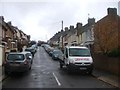
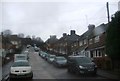
2
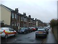
Church Road, Dover
Descending to a junction with Elms Vale Road.
Image: © Robin Webster
Taken: 15 Jun 2019
0.02 miles
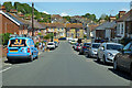
9
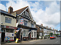
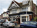
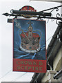
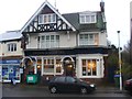
Crown & Sceptre, Dover
A Shepherd Neame pub on Elms Vale Road.
Image: © Oast House Archive
Taken: 17 Jul 2010
0.07 miles
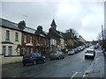
10
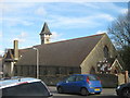
St. Martin of Tours Church (2)
On Church Road.
Image: © David Anstiss
Taken: 27 Feb 2011
0.07 miles