IMAGES TAKEN NEAR TO
Old Folkestone Road, DOVER, CT17 9HD
Introduction
This page details the photographs taken nearby to Old Folkestone Road, CT17 9HD by members of the Geograph project.
The Geograph project started in 2005 with the aim of publishing, organising and preserving representative images for every square kilometre of Great Britain, Ireland and the Isle of Man.

There are currently over 7.5m images from over14,400 individuals and you can help contribute to the project by visiting https://www.geograph.org.uk
Image Map
Images are licensed for reuse under creativecommons.org/licenses/by-sa/2.0
Notes
- Clicking on the map will re-center to the selected point.
- The higher the marker number, the further away the image location is from the centre of the postcode.
Image Listing (56 Images Found)
Images are licensed for reuse under creativecommons.org/licenses/by-sa/2.0
Image
Details
Distance
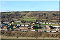
2
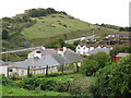
Shakespeare Cliff and the A20 from St David's Avenue
Image: © Nick Smith
Taken: 14 Oct 2009
0.03 miles
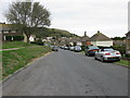
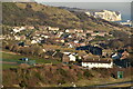
3
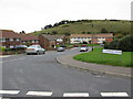
Housing at Aycliff
Housing estate on St David's Avenue & Old Folkestone Road.
Image: © Oast House Archive
Taken: 29 Nov 2012
0.04 miles
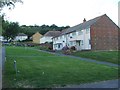
4
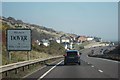
Welcome to Dover
Approaching the town from the A20.
Image: © Oast House Archive
Taken: 24 Oct 2011
0.05 miles
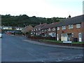
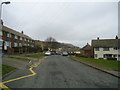
8
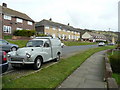
St David's Avenue - view east
Including a 1966 Morris Minor van!
Image: © Jonathan Billinger
Taken: 27 Mar 2008
0.08 miles