IMAGES TAKEN NEAR TO
Battle Of Britain Flats, DOVER, CT17 9AR
Introduction
This page details the photographs taken nearby to Battle Of Britain Flats, CT17 9AR by members of the Geograph project.
The Geograph project started in 2005 with the aim of publishing, organising and preserving representative images for every square kilometre of Great Britain, Ireland and the Isle of Man.

There are currently over 7.5m images from over14,400 individuals and you can help contribute to the project by visiting https://www.geograph.org.uk
Image Map
Images are licensed for reuse under creativecommons.org/licenses/by-sa/2.0
Notes
- Clicking on the map will re-center to the selected point.
- The higher the marker number, the further away the image location is from the centre of the postcode.
Image Listing (1400 Images Found)
Images are licensed for reuse under creativecommons.org/licenses/by-sa/2.0
Image
Details
Distance
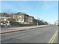
2
Renovation of Battle of Britain flats, York Street
It appeared that the roof tiles were being cleaned.
Image: © John Baker
Taken: 22 Jul 2016
0.01 miles
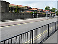
3
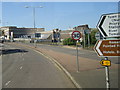
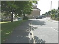
Looking northwest along York Street
With the Unitarian Church across the road and beyond it the Image On the right is part of the Dover Discovery Centre.
Image: © John Baker
Taken: 30 Nov 2012
0.01 miles
4
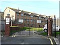
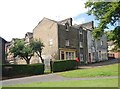
Battle of Britain Homes
These were funded from money originally raised to provide a new hospital for Dover but this never materialised. In 1955 the High Court ruled that the £34,000 collected could be used for some charitable purpose. Eventually it was decided to build almshouses to replace those which were to be demolished in York Street. The Battle of Brtain Homes were built and the tenants of the York Street almshouses moved into them in 1964.
Image: © John Baker
Taken: 30 Nov 2012
0.02 miles
7
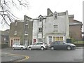
Terrace of derelict houses
On Cowgate Hill, seen from Princes Street. They are numbered 1-7. The cars were just using the allocated parking bays.
Image: © John Baker
Taken: 1 Mar 2013
0.03 miles
9
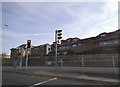
Looking south-southeast along Princes Street
To the site of the Image (which have been demolished). Planning permission has been granted by Dover District Council under application numbers DOV/12/00685 for the “demolition of existing building” and DOV/12/00684 for the “erection of (a) detached building incorporating 8 flats (existing building to be demolished)".
Image: © John Baker
Taken: 1 Aug 2014
0.03 miles
10
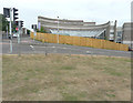
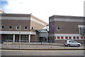
Dover Discovery Centre
It opened on the site of the old White Cliffs Experience in 2003 and is the first integrated learning centre in Kent. Containing the adult, youth and children's libraries, Dover Museum, and an Adult Education Centre, the Discovery Centre project is a partnership between Kent County Council and Dover District Council, and also houses other facilities such as the Discovery Nursery, Matzo's cafe, a UK Online centre, a cinema, and a small theatre. The centre also has a number of rooms available to hire, suitable for 10 to 30 people per room, each with a whiteboard and other facilities available on request http://www.doverlife.co.uk/discoverycentre/
The fence is a very recent addition. The grass verge, on which I was standing, has been bleached by the sun, due to weeks of very little rainfall.
Image: © John Baker
Taken: 2 Sep 2016
0.03 miles