IMAGES TAKEN NEAR TO
London Road, DOVER, CT17 0SQ
Introduction
This page details the photographs taken nearby to London Road, CT17 0SQ by members of the Geograph project.
The Geograph project started in 2005 with the aim of publishing, organising and preserving representative images for every square kilometre of Great Britain, Ireland and the Isle of Man.

There are currently over 7.5m images from over14,400 individuals and you can help contribute to the project by visiting https://www.geograph.org.uk
Image Map
Images are licensed for reuse under creativecommons.org/licenses/by-sa/2.0
Notes
- Clicking on the map will re-center to the selected point.
- The higher the marker number, the further away the image location is from the centre of the postcode.
Image Listing (51 Images Found)
Images are licensed for reuse under creativecommons.org/licenses/by-sa/2.0
Image
Details
Distance
1
Recently completed carpark at Woodside Residential Home, Whitfield Hill
Only two weeks previously, the site had appeared as an Image
Image: © John Baker
Taken: 22 Aug 2014
0.07 miles
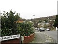
2
Excavation for additional parking
Planning permission has been granted by Dover District Council under application number DOV/12/00923 for the “erection of a three storey rear extension and (the) creation of additional parking” at Woodside Residential Home, Whitfield Hill, Whitfield.
Image: © John Baker
Taken: 8 Aug 2014
0.07 miles
3
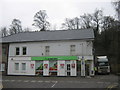
River Co-Operative Supermarket
On Lower Road, opposite Common Lane.
Image: © David Anstiss
Taken: 6 Mar 2011
0.08 miles
4
89, London Road, Temple Ewell
Scaffolding had been erected to roof level. The workmen must have wondered why I was photographing the house.
Image: © John Baker
Taken: 22 Aug 2014
0.08 miles
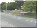
6
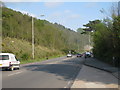
A256, London Road
Oldpark Hill to left.
Image: © Oast House Archive
Taken: 7 May 2010
0.11 miles
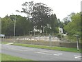
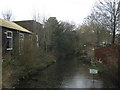
7
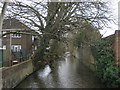
River Dour (2)
As seen from Common Lane roadbridge over the river.
Image: © David Anstiss
Taken: 6 Mar 2011
0.12 miles
8
River Dour
As seen from Common Lane bridge over the river.
On the left is Image
Image: © David Anstiss
Taken: 6 Mar 2011
0.13 miles
9
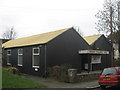
River Village Hall
Corrugated iron building on Common Lane.
Image: © David Anstiss
Taken: 6 Mar 2011
0.13 miles