IMAGES TAKEN NEAR TO
Oswald Road, DOVER, CT17 0JS
Introduction
This page details the photographs taken nearby to Oswald Road, CT17 0JS by members of the Geograph project.
The Geograph project started in 2005 with the aim of publishing, organising and preserving representative images for every square kilometre of Great Britain, Ireland and the Isle of Man.

There are currently over 7.5m images from over14,400 individuals and you can help contribute to the project by visiting https://www.geograph.org.uk
Image Map
Images are licensed for reuse under creativecommons.org/licenses/by-sa/2.0
Notes
- Clicking on the map will re-center to the selected point.
- The higher the marker number, the further away the image location is from the centre of the postcode.
Image Listing (156 Images Found)
Images are licensed for reuse under creativecommons.org/licenses/by-sa/2.0
Image
Details
Distance
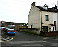
3
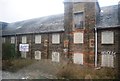
Ikon V Apartments, St Radigund?s Road
A collection of 27 apartments in a mill conversion with period features https://www.wardsofkent.co.uk/new-homes/development/1030/ikon-v-apartments-dover/
Another view of Image showing a better example of the estate agent’s board.
Dover District Council refers to this area of land as The Qube (which was the name of a former nightclub). The Council has granted planning permission under application number DOV/19/00873 for the “erection of an electrical sub station”.
Image: © John Baker
Taken: 7 Mar 2020
0.04 miles
4
Ikon V Apartments, St Radigund?s Road
A collection of 27 apartments in a mill conversion with period features https://www.wardsofkent.co.uk/new-homes/development/1030/ikon-v-apartments-dover/
Another view of Image showing more of the mill conversion.
Dover District Council refers to this area of land as The Qube (which was the name of a former nightclub). The Council has granted planning permission under application number DOV/19/00873 for the “erection of an electrical sub station”.
Image: © John Baker
Taken: 7 Mar 2020
0.04 miles
5
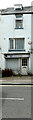
147A, London Road
Planning permission has been granted by Dover District Council under application number DOV/16/00850 for the "erection of a two storey side extension". This would be attached to the right side of the present building.
Image: © John Baker
Taken: 19 Aug 2016
0.04 miles
6
147A, London Road
Planning permission has been granted by Dover District Council under application number DOV/16/00850 for the "erection of a two storey side extension". This would be attached to the left side of the present building.
Image: © John Baker
Taken: 19 Aug 2016
0.04 miles
7
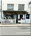
The Wrong End of Town, 196-197 London Road
The shop offers a range of personalised and unique gifts, which are designed and handmade in the shop, for all occasions and budgets. It also offers t-shirt and garment printing, graphic design and branding, wedding stationery and decor, and woodcrafts.
Image: © John Baker
Taken: 24 Jul 2021
0.05 miles
8
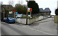
90, Oswald Road
Planning permission has been granted by Dover District Council under application number DOV/19/00910 for the “erection of detached dwelling with integral garage and associated refuse and bicycle storage”.
Construction of the house (behind number 90) is ongoing.
Image: © John Baker
Taken: 19 Feb 2021
0.05 miles
9
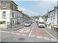
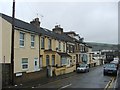
Oswald Road
Seen from St Radigund's Road.
Image: © John Baker
Taken: 31 May 2013
0.05 miles