IMAGES TAKEN NEAR TO
Northbourne Avenue, DOVER, CT17 0BY
Introduction
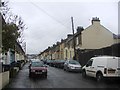
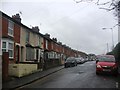
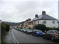
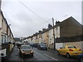
This page details the photographs taken nearby to Northbourne Avenue, CT17 0BY by members of the Geograph project.
The Geograph project started in 2005 with the aim of publishing, organising and preserving representative images for every square kilometre of Great Britain, Ireland and the Isle of Man.

There are currently over 7.5m images from over14,400 individuals and you can help contribute to the project by visiting https://www.geograph.org.uk
Image Map
Images are licensed for reuse under creativecommons.org/licenses/by-sa/2.0
Notes
- Clicking on the map will re-center to the selected point.
- The higher the marker number, the further away the image location is from the centre of the postcode.
Image Listing (23 Images Found)
Images are licensed for reuse under creativecommons.org/licenses/by-sa/2.0
Image
Details
Distance
3
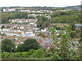
Panorama over Dover from Noah?s Ark Road
Looking down the road in the direction of the castle in Image To its right, the Burlington Hotel rises proud over the town but its days are numbered as it is on the list of buildings to be demolished.
Image: © John Baker
Taken: 28 Dec 2014
0.09 miles
4
View across Dover from the Western Heights 2
Image: © Nick Smith
Taken: 14 Oct 2009
0.11 miles