IMAGES TAKEN NEAR TO
Forge Lane, DOVER, CT16 3LE
Introduction
This page details the photographs taken nearby to Forge Lane, CT16 3LE by members of the Geograph project.
The Geograph project started in 2005 with the aim of publishing, organising and preserving representative images for every square kilometre of Great Britain, Ireland and the Isle of Man.

There are currently over 7.5m images from over14,400 individuals and you can help contribute to the project by visiting https://www.geograph.org.uk
Image Map
Images are licensed for reuse under creativecommons.org/licenses/by-sa/2.0
Notes
- Clicking on the map will re-center to the selected point.
- The higher the marker number, the further away the image location is from the centre of the postcode.
Image Listing (34 Images Found)
Images are licensed for reuse under creativecommons.org/licenses/by-sa/2.0
Image
Details
Distance
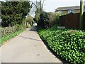
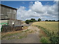
2
Footpath crosses Forge Lane
A footpath from Singledge Wood (heads past Lenacre Farm) and then it heads right, over Forge Lane (via a kissing gate) towards Guilford Avenue. Then it winds its way through Whitfield and onwards to Church Whitfield.
Image: © David Anstiss
Taken: 31 Oct 2010
0.01 miles
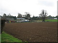
3
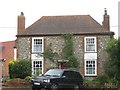
Farmhouse on The Pier
Close to the junction with Forge Lane.
Image: © David Anstiss
Taken: 31 Oct 2010
0.02 miles
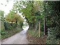
4
Corner of Forge Lane and the Pier, start of footpath
Image: © Nick Smith
Taken: 1 Apr 2007
0.07 miles
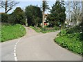
5

Forge Lane
As seen from the junction with Guilford Avenue.
Image: © David Anstiss
Taken: 31 Oct 2010
0.07 miles
8
Whitfield United Reformed Church
On Chapel Road.
Has Congregational and Presbyterian Services.
Image: © David Anstiss
Taken: 31 Oct 2010
0.09 miles
9
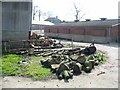
Lenacre Court Farm
As seen from a footpath from Singledge Wood towards Whitfield.
Image: © David Anstiss
Taken: 31 Oct 2010
0.09 miles
10
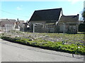
Whitfield United Reformed Church, Chapel Road
Viewed from Forge Lane, planning permission has been granted by Dover District Council under application number DOV/20/00851 for the “erection of three dwellings with associated access (existing church to be demolished)”.
This is the eastern side of Image
Image: © John Baker
Taken: 6 Mar 2021
0.09 miles