IMAGES TAKEN NEAR TO
Pilgrims Way, DOVER, CT16 2DF
Introduction
This page details the photographs taken nearby to Pilgrims Way, CT16 2DF by members of the Geograph project.
The Geograph project started in 2005 with the aim of publishing, organising and preserving representative images for every square kilometre of Great Britain, Ireland and the Isle of Man.

There are currently over 7.5m images from over14,400 individuals and you can help contribute to the project by visiting https://www.geograph.org.uk
Image Map
Images are licensed for reuse under creativecommons.org/licenses/by-sa/2.0
Notes
- Clicking on the map will re-center to the selected point.
- The higher the marker number, the further away the image location is from the centre of the postcode.
Image Listing (42 Images Found)
Images are licensed for reuse under creativecommons.org/licenses/by-sa/2.0
Image
Details
Distance
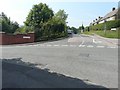
1
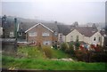
Pilgrims Way
Seen from its junction with Old Park Hill.
Image: © John Baker
Taken: 23 Aug 2013
0.09 miles
2
5, Old Park Avenue
In the back garden, there is a mechanical digger, which appears to have been used in the demolition of a building.
Image: © John Baker
Taken: 13 Mar 2021
0.09 miles
3
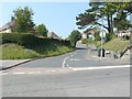
Knights Way
Seen from its junction with Old Park Hill. Note the tall steel fence that has been erected to the right of the bridge; this is to keep people from straying onto the railway. The fence runs along Knights Way to its junction with London Road (River).
Image: © John Baker
Taken: 23 Aug 2013
0.11 miles
4
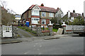
2, Old Park Avenue
Planning permission has been granted by Dover District Council under application number DOV/20/00864 for the “erection of a dwelling house (existing garage and outbuildings to be demolished)”.
If built, the house will be erected to the right of the parked car.
Image: © John Baker
Taken: 16 Apr 2021
0.12 miles
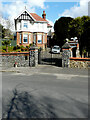
5
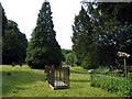
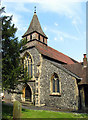
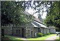
St Andrew, Dover Buckland, Kent - Churchyard
Image: © John Salmon
Taken: 7 Jun 2006
0.12 miles
6
Weavers Way
Seen from its junction with Old Park Hill, which was closed for repairs to its surface beyond the road sign.
Image: © John Baker
Taken: 23 Aug 2013
0.12 miles
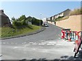
8
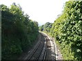
Site of Kearsney Loop Junction
The loop left the main line (between Deal and Dover) on the right of the tracks, just in front of the large, single tree. The loop between Kearsney and Buckland Junctions was opened on 1 July 1882 by the London, Chatham and Dover Railway (LCDR) thus enabling the company to compete with the South Eastern Railway (SER) for the London to Deal traffic. The signal box of the Kearsney Loop Junction was sited at the top of this cutting, on the right hand side. It remained in use until 7 December 1980, when it, and the signal box at Buckland Junction, was closed and the junctions they controlled were operated from Dover Priory. View taken from Old Park Hill bridge.
Image: © John Baker
Taken: 23 Aug 2013
0.12 miles