IMAGES TAKEN NEAR TO
Long Lane, DOVER, CT15 7LU
Introduction
This page details the photographs taken nearby to Long Lane, CT15 7LU by members of the Geograph project.
The Geograph project started in 2005 with the aim of publishing, organising and preserving representative images for every square kilometre of Great Britain, Ireland and the Isle of Man.

There are currently over 7.5m images from over14,400 individuals and you can help contribute to the project by visiting https://www.geograph.org.uk
Image Map
Images are licensed for reuse under creativecommons.org/licenses/by-sa/2.0
Notes
- Clicking on the map will re-center to the selected point.
- The higher the marker number, the further away the image location is from the centre of the postcode.
Image Listing (16 Images Found)
Images are licensed for reuse under creativecommons.org/licenses/by-sa/2.0
Image
Details
Distance
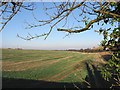
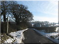
1
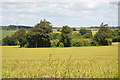
Haynes Farm
View of Haynes Farm and a particularly wide flat topped hedge.
Image: © Nick Smith
Taken: 15 Dec 2007
0.01 miles
4
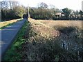
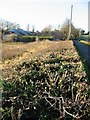
Lane and hedgerow
The hedge was cut flat across the top and was probably 2 metres wide in places.
Image: © Nick Smith
Taken: 15 Dec 2007
0.08 miles
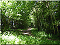
6
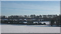
Hedgelines in the snow
As seen from a footpath from Long Lane to Eythorne.
A bridleway follows the lowest hedgeline also to Eythorne.
Image: © David Anstiss
Taken: 26 Dec 2010
0.13 miles
7
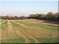
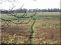
Field near Eythorne
A bridleway to Eythorne follows the tree line to the right of picture.
Image: © Nick Smith
Taken: 15 Dec 2007
0.14 miles
8
Footpath on Long Lane
Long Lane leads towards Coldred Road. In the background is Haynes Farm.
The footpath leading left leads to Eythorne.
Image: © David Anstiss
Taken: 26 Dec 2010
0.14 miles
9
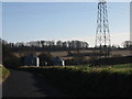
Course of East Kent Light Railway branch
This was the Guilford Colliery branch. This is looking towards the junction with the railway's main line from the level crossing of the Waldershare Park - Golgotha lane. As the colliery never found any coal, both it and the branch railway had a short life.
Image: © Robin Webster
Taken: 15 Jun 2019
0.20 miles