IMAGES TAKEN NEAR TO
Stonehall Road, DOVER, CT15 7LA
Introduction
This page details the photographs taken nearby to Stonehall Road, CT15 7LA by members of the Geograph project.
The Geograph project started in 2005 with the aim of publishing, organising and preserving representative images for every square kilometre of Great Britain, Ireland and the Isle of Man.

There are currently over 7.5m images from over14,400 individuals and you can help contribute to the project by visiting https://www.geograph.org.uk
Image Map
Images are licensed for reuse under creativecommons.org/licenses/by-sa/2.0
Notes
- Clicking on the map will re-center to the selected point.
- The higher the marker number, the further away the image location is from the centre of the postcode.
Image Listing (45 Images Found)
Images are licensed for reuse under creativecommons.org/licenses/by-sa/2.0
Image
Details
Distance
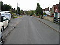
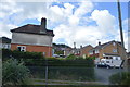
3
One of the entrances to The Close, Lydden
Image: © Nick Smith
Taken: 25 Apr 2008
0.03 miles
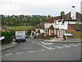
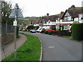
6
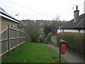
Footpath to Stonehall Road
This green path leads from Bosney Banks down to a road in Lydden. In the background valleys above Broadfield Farm.
Image: © David Anstiss
Taken: 6 Mar 2011
0.07 miles
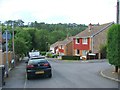
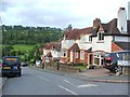
8
Turning to Lydden village off the old A2
Image: © David Long
Taken: 20 Apr 2006
0.08 miles
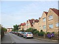
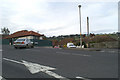
10
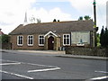
Living Well Family Church, part of the Apostolic Church of Great Britain
Canterbury Road, Lydden.
Image: © Nick Smith
Taken: 18 May 2008
0.09 miles