IMAGES TAKEN NEAR TO
Canterbury Road, DOVER, CT15 7ES
Introduction
This page details the photographs taken nearby to Canterbury Road, CT15 7ES by members of the Geograph project.
The Geograph project started in 2005 with the aim of publishing, organising and preserving representative images for every square kilometre of Great Britain, Ireland and the Isle of Man.

There are currently over 7.5m images from over14,400 individuals and you can help contribute to the project by visiting https://www.geograph.org.uk
Image Map
Images are licensed for reuse under creativecommons.org/licenses/by-sa/2.0
Notes
- Clicking on the map will re-center to the selected point.
- The higher the marker number, the further away the image location is from the centre of the postcode.
Image Listing (37 Images Found)
Images are licensed for reuse under creativecommons.org/licenses/by-sa/2.0
Image
Details
Distance
1
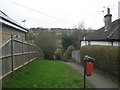
Footpath to Stonehall Road
This green path leads from Bosney Banks down to a road in Lydden. In the background valleys above Broadfield Farm.
Image: © David Anstiss
Taken: 6 Mar 2011
0.01 miles
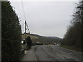
2
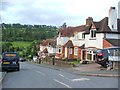
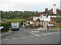
Turning to Lydden village off the old A2
Image: © David Long
Taken: 20 Apr 2006
0.02 miles
3
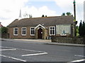
Living Well Family Church, part of the Apostolic Church of Great Britain
Canterbury Road, Lydden.
Image: © Nick Smith
Taken: 18 May 2008
0.03 miles
4
Bosney Banks
This road leads from Lydden Hill around Lydden (on the left) and then down to Temple Ewell and more suburbs of Dover.
In the background is Lydden Temple Ewell National Nature Reserve on the hillside above Sun Valley Farm.
Image: © David Anstiss
Taken: 6 Mar 2011
0.05 miles
5
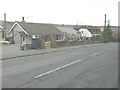
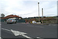
Building work at 56 Canterbury Road
Planning permission has been granted by Dover District Council under application number DOV//13/00177 for the “installation of 2 bay windows and construction of porch”.
Image: © John Baker
Taken: 7 Mar 2014
0.05 miles
6
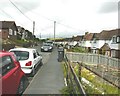
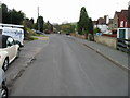
Stonehall Road, Lydden
Seen from the next square to Nick Smith's Image Even though his and my photographs were both taken on a Friday, mine showed a line of parked cars while his showed an almost empty road.
Image: © John Baker
Taken: 3 Aug 2012
0.05 miles
7
One of the entrances to The Close, Lydden
Image: © Nick Smith
Taken: 25 Apr 2008
0.06 miles
8
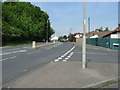
Junction of Stonehall Road with B2060
This section of the B2060 is called Bosney Banks and was originally the A2 London to Dover road.
Image: © Nick Smith
Taken: 24 May 2008
0.06 miles