IMAGES TAKEN NEAR TO
Seymour Road, DOVER, CT15 6HQ
Introduction
This page details the photographs taken nearby to Seymour Road, CT15 6HQ by members of the Geograph project.
The Geograph project started in 2005 with the aim of publishing, organising and preserving representative images for every square kilometre of Great Britain, Ireland and the Isle of Man.

There are currently over 7.5m images from over14,400 individuals and you can help contribute to the project by visiting https://www.geograph.org.uk
Image Map
Images are licensed for reuse under creativecommons.org/licenses/by-sa/2.0
Notes
- Clicking on the map will re-center to the selected point.
- The higher the marker number, the further away the image location is from the centre of the postcode.
Image Listing (23 Images Found)
Images are licensed for reuse under creativecommons.org/licenses/by-sa/2.0
Image
Details
Distance
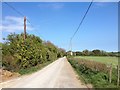
1
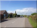
Seymour Road, St. Margaret's at Cliffe
Image: © Chris Whippet
Taken: 23 Apr 2017
0.01 miles
2
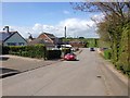
Seymour Road, St. Margaret's at Cliffe
Image: © Chris Whippet
Taken: 23 Apr 2017
0.05 miles
3
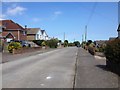
Collingwood Road, St. Margaret's at Cliffe
Image: © Chris Whippet
Taken: 23 Apr 2017
0.06 miles
4
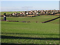
View across the valley to houses on Mill Hill
Taken from the footpath from St Margaret's to Kingsdown.
Image: © Nick Smith
Taken: 12 Jan 2008
0.07 miles
5
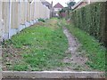
Footpath through to Collingwood Road from St Vincent Road
Image: © Nick Smith
Taken: 24 Feb 2007
0.07 miles
6
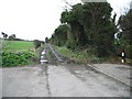
The point where St Vincent Road turns into a muddy track
Image: © Nick Smith
Taken: 24 Feb 2007
0.08 miles
7
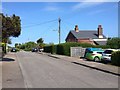
St. Vincent Road, St. Margaret's at Cliffe
Image: © Chris Whippet
Taken: 23 Apr 2017
0.10 miles
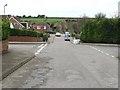
9
Collingwood Road, St. Margaret's at Cliffe
Image: © Chris Whippet
Taken: 23 Apr 2017
0.12 miles
10
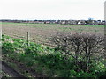
View across the fields from bridleway
The houses are on Nelson Park Road, St Margaret's at Cliffe
Image: © Nick Smith
Taken: 26 Jan 2008
0.15 miles