IMAGES TAKEN NEAR TO
The Parsonage, High Street, DOVER, CT15 6AS
Introduction
This page details the photographs taken nearby to The Parsonage, High Street, CT15 6AS by members of the Geograph project.
The Geograph project started in 2005 with the aim of publishing, organising and preserving representative images for every square kilometre of Great Britain, Ireland and the Isle of Man.

There are currently over 7.5m images from over14,400 individuals and you can help contribute to the project by visiting https://www.geograph.org.uk
Image Map
Images are licensed for reuse under creativecommons.org/licenses/by-sa/2.0
Notes
- Clicking on the map will re-center to the selected point.
- The higher the marker number, the further away the image location is from the centre of the postcode.
Image Listing (168 Images Found)
Images are licensed for reuse under creativecommons.org/licenses/by-sa/2.0
Image
Details
Distance
1
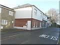
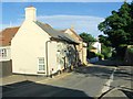
Bliss Cottage, High Street
I have taken this view on two occasions Image but now it is occupied it has been given a name.
Image: © John Baker
Taken: 16 Dec 2012
0.01 miles
4

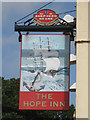
The Hope Inn, St. Margaret's at Cliffe
Image: © Chris Whippet
Taken: 19 Aug 2010
0.01 miles
5
The Hope Inn, St Margaret's At Cliffe
A Shepherd Neame pub on Sea Street.
Image: © Oast House Archive
Taken: 24 Jul 2010
0.01 miles
6
The Hope Inn, St. Margaret's at Cliffe
Image: © Chris Whippet
Taken: 4 Jul 2015
0.01 miles
7
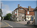
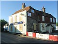
The Hope Inn (closed)
A former Shepherd Neame house.
Image: © Robin Webster
Taken: 26 Sep 2015
0.01 miles
8
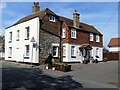
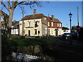
St Margaret's at Cliffe buildings [12]
Now a private residence, this building in High Street was the former Hope Inn public house. Built in the 18th century and extended in the late 19th century. Constructed of flint and red brick, partly rendered, the extension in painted brick and tile hanging, all under a tile roof. Listed, grade II, with details at: https://historicengland.org.uk/listing/the-list/list-entry/1101466
St Margaret’s at Cliffe is a coastal village some 3 miles northeast of Dover. The village is the place in Britain that is nearest to the coast of France, 18 miles distant. The area has been settled since Anglo-Saxon times, and the village became a high class resort in the nineteenth century. The area has always been at the front line of cross Channel conflicts.
Image: © Michael Dibb
Taken: 12 Sep 2021
0.01 miles
10
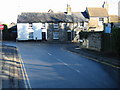
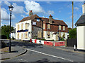
Junction of Reach Road and the High Street
Image: © Nick Smith
Taken: 12 Jan 2008
0.02 miles