IMAGES TAKEN NEAR TO
Tangier Close, DOVER, CT15 5LF
Introduction
This page details the photographs taken nearby to Tangier Close, CT15 5LF by members of the Geograph project.
The Geograph project started in 2005 with the aim of publishing, organising and preserving representative images for every square kilometre of Great Britain, Ireland and the Isle of Man.

There are currently over 7.5m images from over14,400 individuals and you can help contribute to the project by visiting https://www.geograph.org.uk
Image Map
Images are licensed for reuse under creativecommons.org/licenses/by-sa/2.0
Notes
- Clicking on the map will re-center to the selected point.
- The higher the marker number, the further away the image location is from the centre of the postcode.
Image Listing (11 Images Found)
Images are licensed for reuse under creativecommons.org/licenses/by-sa/2.0
Image
Details
Distance
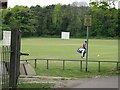
3
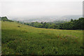
Field off Dover Road
Looking over a misty Dover.
Image: © Oast House Archive
Taken: 24 Jul 2010
0.10 miles
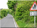
4
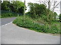
Junction of Old Charlton Road with Dover Road
It doesn't look it in the picture but it is quite a steep exit on to Dover Road
Image: © Nick Smith
Taken: 5 May 2007
0.11 miles
5
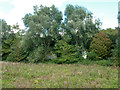
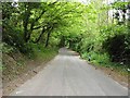
Old quarry by Old Charlton Road
Apparently the quarry floor was once a playing field, but apart from being evenly level, there is no sign of that now.
Image: © Robin Webster
Taken: 26 Sep 2015
0.14 miles
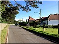
6
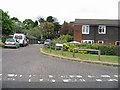
Part of the Burgoyne Heights housing estate
Image: © Nick Smith
Taken: 5 May 2007
0.16 miles
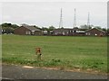
8
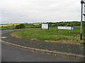
Junction of Burgoyne Heights with Dover Road
Image: © Nick Smith
Taken: 5 May 2007
0.18 miles