IMAGES TAKEN NEAR TO
Singledge Lane, DOVER, CT15 5AA
Introduction
This page details the photographs taken nearby to Singledge Lane, CT15 5AA by members of the Geograph project.
The Geograph project started in 2005 with the aim of publishing, organising and preserving representative images for every square kilometre of Great Britain, Ireland and the Isle of Man.

There are currently over 7.5m images from over14,400 individuals and you can help contribute to the project by visiting https://www.geograph.org.uk
Image Map
Images are licensed for reuse under creativecommons.org/licenses/by-sa/2.0
Notes
- Clicking on the map will re-center to the selected point.
- The higher the marker number, the further away the image location is from the centre of the postcode.
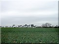
Image Listing (10 Images Found)
Images are licensed for reuse under creativecommons.org/licenses/by-sa/2.0
Image
Details
Distance
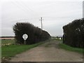
2
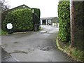
Entrance to Longfield caravan park, Whitfield
Image: © Nick Smith
Taken: 4 Mar 2007
0.03 miles
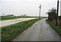
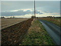
9
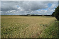
Wheat Field at Temple Farm
From Singledge Lane.
Image: © Oast House Archive
Taken: 17 Jul 2010
0.23 miles
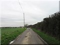
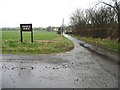
10
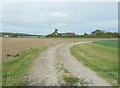
Track to Temple Farm
Also doubles as a bridleway.
Image: © John Baker
Taken: 16 Jun 2013
0.24 miles