IMAGES TAKEN NEAR TO
Cypress Grove, DOVER, CT15 4NP
Introduction
This page details the photographs taken nearby to Cypress Grove, CT15 4NP by members of the Geograph project.
The Geograph project started in 2005 with the aim of publishing, organising and preserving representative images for every square kilometre of Great Britain, Ireland and the Isle of Man.

There are currently over 7.5m images from over14,400 individuals and you can help contribute to the project by visiting https://www.geograph.org.uk
Image Map (Loading...)


Getting Data...Please wait
Leaflet Map data © OpenStreetMap
Images are licensed for reuse under creativecommons.org/licenses/by-sa/2.0
Notes
- Clicking on the map will re-center to the selected point.
- The higher the marker number, the further away the image location is from the centre of the postcode.
Image Listing (17 Images Found)
Images are licensed for reuse under creativecommons.org/licenses/by-sa/2.0
Image
Details
Distance
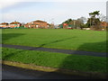
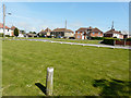
1
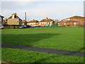
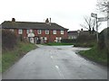
View across the green to St John's Road from Fairview Road
Image: © Nick Smith
Taken: 5 Jan 2008
0.05 miles
3
View NE from Roman Way, Elvington
The 3 cooling towers of the disused Richborough power station can just be seen on the horizon ~12km away.
Image: © Nick Smith
Taken: 5 Jan 2008
0.11 miles
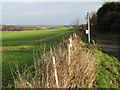
4
Looking east-southeast from a byway
4, St John’s Road is the house with scaffolding on its frontage.
Image: © John Baker
Taken: 10 May 2015
0.14 miles
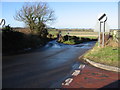
5
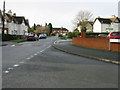
Road junction at Elvington village.
Entering Elvington from the N.
Image: © Nick Smith
Taken: 6 Jan 2007
0.14 miles
6
Two roads from Elvington
Neither road appears to have a name on the maps available. Taken from the junction with Roman Way.
Image: © Nick Smith
Taken: 6 Jan 2008
0.15 miles
7
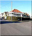
39, Adelaide Road
Planning permission has been granted by Dover District Council under application number DOV/10/00022 for the “change of use to 2 dwellings and construction of vehicular access”.
Image: © John Baker
Taken: 3 Feb 2019
0.16 miles
8
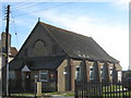
Pentecostal Church, Elvington
On Milner Road.
Image: © David Anstiss
Taken: 26 Dec 2010
0.16 miles
9
View along Milner Road from junction with St John's Road
Elvington was originally built in the early part of the 20th Century as a mining village to serve the neighbouring Tilmanstone colliery which finally closed in 1986.
Image: © Nick Smith
Taken: 5 Jan 2008
0.17 miles
10
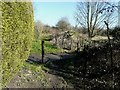
Sawn off lengths of original bullhead rail
Seen from the end of a footpath from Terrace Road and mentioned in the http://www.disused-stations.org.uk/e/elvington/index.shtml these had been used on the EKLR (East Kent Light railway) as a vehicle barrier at the start of Burgess Hill.
Image: © John Baker
Taken: 27 Feb 2015
0.18 miles