IMAGES TAKEN NEAR TO
Nonington, DOVER, CT15 4ET
Introduction
This page details the photographs taken nearby to CT15 4ET by members of the Geograph project.
The Geograph project started in 2005 with the aim of publishing, organising and preserving representative images for every square kilometre of Great Britain, Ireland and the Isle of Man.

There are currently over 7.5m images from over14,400 individuals and you can help contribute to the project by visiting https://www.geograph.org.uk
Image Map
Images are licensed for reuse under creativecommons.org/licenses/by-sa/2.0
Notes
- Clicking on the map will re-center to the selected point.
- The higher the marker number, the further away the image location is from the centre of the postcode.
Image Listing (15 Images Found)
Images are licensed for reuse under creativecommons.org/licenses/by-sa/2.0
Image
Details
Distance
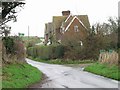
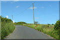
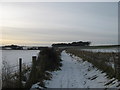
2
Lane between Kittington Farm and Kittington Cottages
An unnamed lane leads from Elvington past Kittington Farm and the cottages (in the background) heading towards St Alban's Downs. A footpath leads left along a track towards Barfrestone.
Image: © David Anstiss
Taken: 26 Dec 2010
0.01 miles
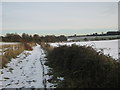
3
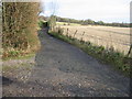
Track and footpath leading to Thornton Lane
Heading NE the path joins The Downs another footpath/bridleway and leads to Thornton Lane, SW the path ends at Limekiln Plantation just outside Barfrestone.
Image: © Nick Smith
Taken: 5 Jan 2008
0.01 miles
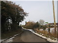
4
View across the fields near Kittington Cottages
The route of the path in Image follows the fence line across the middle of the photo.
Image: © Nick Smith
Taken: 5 Jan 2008
0.04 miles
5
Heading north on Kelk Hill
A sprinkling of poppies along the verges.
Image: © Robin Webster
Taken: 15 Jun 2019
0.11 miles
6
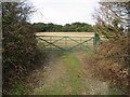
Brown Pudding Plantation beyond the gated field
Image: © Nick Smith
Taken: 5 Jan 2008
0.12 miles
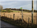
7
Footpath to Kelk Hill woods
A farm track leads from Kittington Cottages near Kittington Farm, to the woods and onwards to Round Wood near Thornton.
Image: © David Anstiss
Taken: 26 Dec 2010
0.14 miles
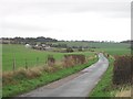
8
Kittington Cottages and the road to Elvington
Looking S from Kelk Hill to Kittington Cottages and the road to Elvington.
Image: © Nick Smith
Taken: 6 Jan 2007
0.15 miles
9
Footpath to Kittington Cottages
A farm track leads from Round Wood near Thornton, towards the cottages near Kittington Farm.
Brown Pudding Plantation is in the background.
Image: © David Anstiss
Taken: 26 Dec 2010
0.17 miles
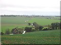
10
View of Kittington Farm and surrounding fields from the south
Image: © Nick Smith
Taken: 7 Jan 2007
0.19 miles