IMAGES TAKEN NEAR TO
Victoria Mews, Bridgeside, DEAL, CT14 9ST
Introduction
This page details the photographs taken nearby to Victoria Mews, Bridgeside, CT14 9ST by members of the Geograph project.
The Geograph project started in 2005 with the aim of publishing, organising and preserving representative images for every square kilometre of Great Britain, Ireland and the Isle of Man.

There are currently over 7.5m images from over14,400 individuals and you can help contribute to the project by visiting https://www.geograph.org.uk
Image Map
Images are licensed for reuse under creativecommons.org/licenses/by-sa/2.0
Notes
- Clicking on the map will re-center to the selected point.
- The higher the marker number, the further away the image location is from the centre of the postcode.
Image Listing (197 Images Found)
Images are licensed for reuse under creativecommons.org/licenses/by-sa/2.0
Image
Details
Distance

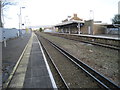
7
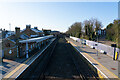
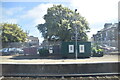
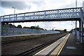
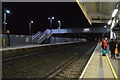
Deal railway station
Viewed from the station footbridge.
Image: © Bill Boaden
Taken: 30 Jun 2012
0.03 miles
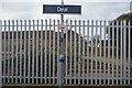
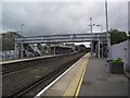
8
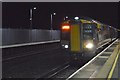
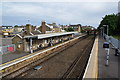
Deal railway station, Kent
Opened in 1847 by the South Eastern Railway as a branch from Minster, the line would later be extended to Dover. View north towards Minster and Ramsgate.
Image: © Nigel Thompson
Taken: 7 Jan 2012
0.03 miles