IMAGES TAKEN NEAR TO
Minters Industrial Estate, Southwall Road, DEAL, CT14 9PZ
Introduction
This page details the photographs taken nearby to Minters Industrial Estate, Southwall Road, CT14 9PZ by members of the Geograph project.
The Geograph project started in 2005 with the aim of publishing, organising and preserving representative images for every square kilometre of Great Britain, Ireland and the Isle of Man.

There are currently over 7.5m images from over14,400 individuals and you can help contribute to the project by visiting https://www.geograph.org.uk
Image Map
Images are licensed for reuse under creativecommons.org/licenses/by-sa/2.0
Notes
- Clicking on the map will re-center to the selected point.
- The higher the marker number, the further away the image location is from the centre of the postcode.
Image Listing (38 Images Found)
Images are licensed for reuse under creativecommons.org/licenses/by-sa/2.0
Image
Details
Distance
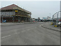
1
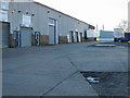
Small industrial estate off Southwall Road
Known as Minters industrial estate.
Image: © Nick Smith
Taken: 17 Feb 2008
0.04 miles
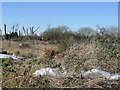
2
Wasteland near Minters industrial estate, Southwall Road
Image: © Nick Smith
Taken: 17 Feb 2008
0.08 miles
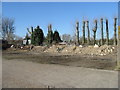
3
Wasteland to the NW of Minters industrial estate
Image: © Nick Smith
Taken: 17 Feb 2008
0.08 miles
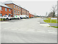
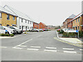
4
Court Marsh Road, Pottery Grove
The view, from this road, shows a row of newly constructed houses.
Pottery Grove is the name, which has been given to this housing estate.
Image: © John Baker
Taken: 20 Mar 2022
0.09 miles
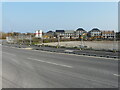
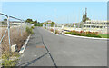
5
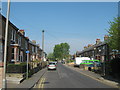
Southwall Road, Deal
This road leads from Middle Deal Road towards Church Lane.
It is also part of a cycle route towards Fowlmead Country Park.
Image: © David Anstiss
Taken: 17 Apr 2011
0.10 miles
6
Wallers Road, Pottery Grove
Pottery Grove is the name, which has been given to this housing estate.
Image: © John Baker
Taken: 12 Feb 2023
0.10 miles
7
Court Marsh Road, Pottery Grove
Pottery Grove is the name, which has been given to this housing estate.
Image: © John Baker
Taken: 12 Feb 2023
0.12 miles
8
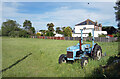
Field on the edge of town
This is along South Wall where the suburbs of Deal give way to more open countryside.
Image: © Des Blenkinsopp
Taken: 11 Jun 2021
0.12 miles
9
Poplar Drive, Pottery Grove
Pottery Grove is the name, which has been given to this housing estate.
Image: © John Baker
Taken: 12 Feb 2023
0.12 miles
10
Poplar Drive, Pottery Grove
Pottery Grove is the name, which has been given to this housing estate.
Image: © John Baker
Taken: 5 Sep 2021
0.13 miles