IMAGES TAKEN NEAR TO
Mill Hill, DEAL, CT14 9JA
Introduction
This page details the photographs taken nearby to Mill Hill, CT14 9JA by members of the Geograph project.
The Geograph project started in 2005 with the aim of publishing, organising and preserving representative images for every square kilometre of Great Britain, Ireland and the Isle of Man.

There are currently over 7.5m images from over14,400 individuals and you can help contribute to the project by visiting https://www.geograph.org.uk
Image Map
Images are licensed for reuse under creativecommons.org/licenses/by-sa/2.0
Notes
- Clicking on the map will re-center to the selected point.
- The higher the marker number, the further away the image location is from the centre of the postcode.
Image Listing (25 Images Found)
Images are licensed for reuse under creativecommons.org/licenses/by-sa/2.0
Image
Details
Distance
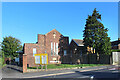
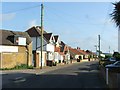
2
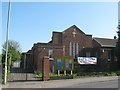
St. Richard's Church Centre, Walmer
On Mill Hill.
Image: © David Anstiss
Taken: 17 Apr 2011
0.03 miles
3
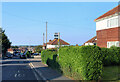
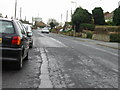
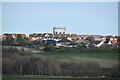
Bus Stop on Mill Hill
There is a gentle slope down from the top of Mill Hill. Around 30 metres aod just here.
Image: © Des Blenkinsopp
Taken: 12 Jun 2021
0.03 miles
5
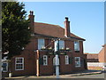
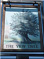
Yew Tree Public house, Walmer
On Mill Hill.
Image: © David Anstiss
Taken: 17 Apr 2011
0.04 miles
9
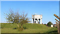
Water Tower and Reservoir
A Southern Water site along St Richards Road.
Image: © Des Blenkinsopp
Taken: 12 Jun 2021
0.09 miles