IMAGES TAKEN NEAR TO
Ringwould, DEAL, CT14 8FD
Introduction
This page details the photographs taken nearby to CT14 8FD by members of the Geograph project.
The Geograph project started in 2005 with the aim of publishing, organising and preserving representative images for every square kilometre of Great Britain, Ireland and the Isle of Man.

There are currently over 7.5m images from over14,400 individuals and you can help contribute to the project by visiting https://www.geograph.org.uk
Image Map
Images are licensed for reuse under creativecommons.org/licenses/by-sa/2.0
Notes
- Clicking on the map will re-center to the selected point.
- The higher the marker number, the further away the image location is from the centre of the postcode.
Image Listing (46 Images Found)
Images are licensed for reuse under creativecommons.org/licenses/by-sa/2.0
Image
Details
Distance
1
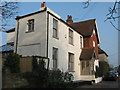
Number One, Ringwould
House on Back Street.
Image: © David Anstiss
Taken: 27 Mar 2011
0.02 miles
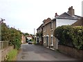
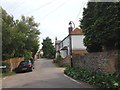
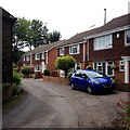
2
View along Back Street, Ringwould
Hangmans Lane off to the left
Image: © Nick Smith
Taken: 4 Jul 2007
0.02 miles
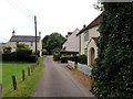
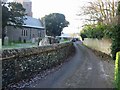
4
Hangman's Lane
Hangman's Lane at junction with Front Street, Ringwould
Image: © Hugh Craddock
Taken: 3 Sep 2016
0.03 miles
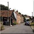
7
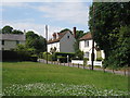
Houses on Hangman's Lane
A dead end road leading to Westfields Nursery.
Image: © Oast House Archive
Taken: 24 Jul 2010
0.05 miles