IMAGES TAKEN NEAR TO
Victoria Road, DEAL, CT14 7BN
Introduction
This page details the photographs taken nearby to Victoria Road, CT14 7BN by members of the Geograph project.
The Geograph project started in 2005 with the aim of publishing, organising and preserving representative images for every square kilometre of Great Britain, Ireland and the Isle of Man.

There are currently over 7.5m images from over14,400 individuals and you can help contribute to the project by visiting https://www.geograph.org.uk
Image Map
Images are licensed for reuse under creativecommons.org/licenses/by-sa/2.0
Notes
- Clicking on the map will re-center to the selected point.
- The higher the marker number, the further away the image location is from the centre of the postcode.
Image Listing (692 Images Found)
Images are licensed for reuse under creativecommons.org/licenses/by-sa/2.0
Image
Details
Distance
2
Looking E along Sondes Road towards the seafront
Image: © Nick Smith
Taken: 17 Sep 2008
0.02 miles
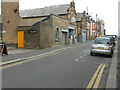
3
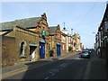
The Court Yard Oyster Bar, Sondes Road
The restaurant is in the two blue fronted buildings, the address is given as The Old Coach House but I can't find out much about the former use of the buildings.
http://www.thebestof.co.uk/deal%20and%20dover/51444/1/1/the_best_of.aspx and http://www.thecourtyarddeal.com/ for info.
Image: © Nick Smith
Taken: 17 Sep 2008
0.02 miles
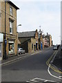
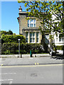
6
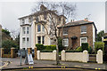
5 - 9 Victoria Road
Late Victorian villas on Victoria Road, opposite Sondes Road.
Image: © Ian Capper
Taken: 25 Jan 2014
0.02 miles
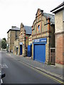
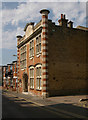
8
The Courtyard Oyster Bar & Restaurant, The Old Coach House, Sondes Road
Planning permission has been granted by Dover District Council under application number DOV/19/00800 for the “change of use of land and building and the provision of a bin store, elevational alterations to building, additional internal seating area, a covered courtyard area and the erection of a smoking shelter for purposes ancillary to the use of the adjoining building and land as a bar and restaurant”.
Image: © John Baker
Taken: 18 Oct 2020
0.03 miles
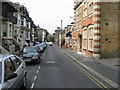
9
1a, Victoria Road
The railings along the front boundary wall have been erected since 2017.
Image: © John Baker
Taken: 12 May 2019
0.03 miles
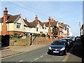
10
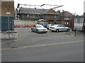
The back of Homeleigh, 3, Sondes Road
Seen across a carpark in South Street, planning permission has been granted by Dover District Council under application number DOV/14/00009 for the “erection of dormer roof extensions”. This is the front of Image
Image: © John Baker
Taken: 20 Mar 2016
0.03 miles