IMAGES TAKEN NEAR TO
Ranelagh Road, DEAL, CT14 7BG
Introduction
This page details the photographs taken nearby to Ranelagh Road, CT14 7BG by members of the Geograph project.
The Geograph project started in 2005 with the aim of publishing, organising and preserving representative images for every square kilometre of Great Britain, Ireland and the Isle of Man.

There are currently over 7.5m images from over14,400 individuals and you can help contribute to the project by visiting https://www.geograph.org.uk
Image Map (Loading...)


Getting Data...Please wait
Leaflet Map data © OpenStreetMap
Images are licensed for reuse under creativecommons.org/licenses/by-sa/2.0
Notes
- Clicking on the map will re-center to the selected point.
- The higher the marker number, the further away the image location is from the centre of the postcode.
Image Listing (541 Images Found)
Images are licensed for reuse under creativecommons.org/licenses/by-sa/2.0
Image
Details
Distance
2
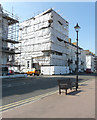
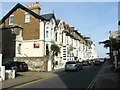
Wellington Lodge, Flat 1, 15, Prince Of Wales Terrace
Planning permission has been granted by Dover District Council under application number DOV/19/01359 for the “installation of replacement UPVC windows to basement and ground floor flat (retrospective)”.
Image: © John Baker
Taken: 27 May 2020
0.02 miles
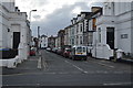
4
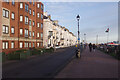
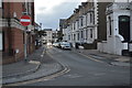
Prince of Wales Terrace, Deal
Stretching away north of the junction with Ranelagh Road, these fine terraces overlook Deal's beach.
Image: © Stephen McKay
Taken: 11 Dec 2021
0.03 miles
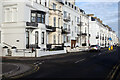
5
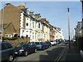
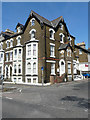
Prince of Wales Terrace, Deal
Although it is hard to envisage now, this was the site of an important Royal Navy yard from the 16th century until its closure in 1863. Its main role was to service the fleet but it also built special flat-bottomed boats for Nelson's attack on Boulogne in 1801. After closure the Admiralty sold the land and it became an estate of up-market houses, including a typical Victorian seaside terrace, which still exists today. The block of apartments on the left, however, dates only from 1990 replacing the Queens Hotel which was destroyed by fire in 1981.
Image: © Stephen McKay
Taken: 11 Dec 2021
0.03 miles
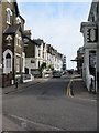
10
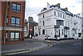
Flats 1-5 Goodwin House, 38, Victoria Road
Planning permission has been granted by Dover District Council under application number 20/00181 to “replace existing windows and door with upvc”.
Flat 1’s window is in the basement, to the left of the one-way road sign, flat 2 has a bay-window on the first floor as does flat 3, which is on the second floor. Flat 4 is above on the third floor, while flat 5 is on the fourth floor, under the eaves.
Image: © John Baker
Taken: 27 May 2020
0.03 miles