IMAGES TAKEN NEAR TO
Broad Lane, DEAL, CT14 0LX
Introduction
This page details the photographs taken nearby to Broad Lane, CT14 0LX by members of the Geograph project.
The Geograph project started in 2005 with the aim of publishing, organising and preserving representative images for every square kilometre of Great Britain, Ireland and the Isle of Man.

There are currently over 7.5m images from over14,400 individuals and you can help contribute to the project by visiting https://www.geograph.org.uk
Image Map
Images are licensed for reuse under creativecommons.org/licenses/by-sa/2.0
Notes
- Clicking on the map will re-center to the selected point.
- The higher the marker number, the further away the image location is from the centre of the postcode.
Image Listing (38 Images Found)
Images are licensed for reuse under creativecommons.org/licenses/by-sa/2.0
Image
Details
Distance
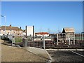
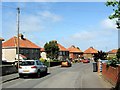
1
Houses on Broad Lane
Small housing estate to south of Finglesham.
Image: © Oast House Archive
Taken: 24 Jul 2010
0.01 miles
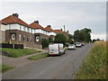
5
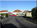
Housing on Circular Road, Betteshanger
Circular Road, houses shown are on N side, near the exit/entrance of circle from Broad lane.
Image: © Nick Smith
Taken: 4 Jan 2007
0.06 miles
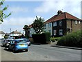
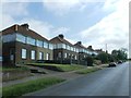
8
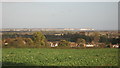
View from Broad Lane, Finglesham
Looking across a field and over the village towards the Isle of Thanet in the background.
Image: © David Anstiss
Taken: 30 Oct 2010
0.08 miles
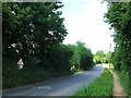
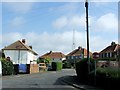
9
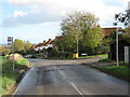
Bus stops on Broad Lane
Broad Lane leads from Little Betteshanger towards the A258 London Road.
Image: © David Anstiss
Taken: 30 Oct 2010
0.09 miles