IMAGES TAKEN NEAR TO
Whites Hill, DEAL, CT14 0JB
Introduction
This page details the photographs taken nearby to Whites Hill, CT14 0JB by members of the Geograph project.
The Geograph project started in 2005 with the aim of publishing, organising and preserving representative images for every square kilometre of Great Britain, Ireland and the Isle of Man.

There are currently over 7.5m images from over14,400 individuals and you can help contribute to the project by visiting https://www.geograph.org.uk
Image Map
Images are licensed for reuse under creativecommons.org/licenses/by-sa/2.0
Notes
- Clicking on the map will re-center to the selected point.
- The higher the marker number, the further away the image location is from the centre of the postcode.
Image Listing (16 Images Found)
Images are licensed for reuse under creativecommons.org/licenses/by-sa/2.0
Image
Details
Distance
1
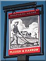
Plough and Harrow sign
Sign for Image, a Shepherd Neame pub on Dover Road.
Image: © Oast House Archive
Taken: 16 Oct 2011
0.08 miles
2

Plough and Harrow
A Shepherd Neame pub on Dover Road.
Image: © Oast House Archive
Taken: 16 Oct 2011
0.08 miles
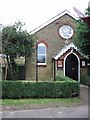
4

Plough and Harrow Public house.
On the junction of Dover road and Chapel road.
Image: © Nick Smith
Taken: 3 Jan 2007
0.13 miles
6
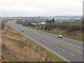
Looking S along the A256 Tilmanstone bypass
The Plough and Harrow http://www.geograph.org.uk/photo/303714 can be seen in the centre of the photo
Image: © Nick Smith
Taken: 7 Mar 2009
0.13 miles
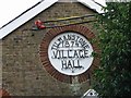
7
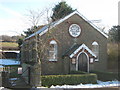
Tilmanstone Village Hall
On Chapel Road.
Image: © David Anstiss
Taken: 26 Dec 2010
0.13 miles
8
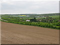
View towards Tilmanstone
The white building in centre of photo is http://www.geograph.org.uk/photo/303714 the Plough and Harrow
Image: © Nick Smith
Taken: 3 May 2009
0.16 miles
9
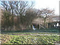
Footpath junction near Tilmanstone
A footpath from Craythorne Firs leads straight on towards Lower Street.
Another footpath crosses from Breville Road left, towards Chapel Road.
Image: © David Anstiss
Taken: 26 Dec 2010
0.17 miles
10
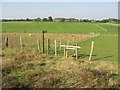
Stile and footpath across the fields near Tilmanstone
Image: © Nick Smith
Taken: 21 Oct 2007
0.18 miles