IMAGES TAKEN NEAR TO
Paddock Close, DEAL, CT14 0AE
Introduction
This page details the photographs taken nearby to Paddock Close, CT14 0AE by members of the Geograph project.
The Geograph project started in 2005 with the aim of publishing, organising and preserving representative images for every square kilometre of Great Britain, Ireland and the Isle of Man.

There are currently over 7.5m images from over14,400 individuals and you can help contribute to the project by visiting https://www.geograph.org.uk
Image Map
Images are licensed for reuse under creativecommons.org/licenses/by-sa/2.0
Notes
- Clicking on the map will re-center to the selected point.
- The higher the marker number, the further away the image location is from the centre of the postcode.
Image Listing (56 Images Found)
Images are licensed for reuse under creativecommons.org/licenses/by-sa/2.0
Image
Details
Distance
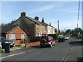
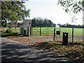
1
Bus stop in Sholden New Road
It is situated almost opposite Paddock Close, whose entrance can be seen on the right. Number 13 and 13A buses stop here on their ways from Sandwich. Behind the bus stop is the Sholden Fields housing development; this part is still under construction.
Image: © John Baker
Taken: 2 Jul 2014
0.05 miles
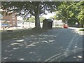
3
Sholden New Road
Paddock Close bus stop on the left, opposite Paddock Close itself.
Image: © Robin Webster
Taken: 14 Oct 2017
0.06 miles
4
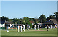
Cricket at Sholden
Sholden cricket ground is in the centre of the village.
Image: © Des Blenkinsopp
Taken: 13 Jun 2021
0.07 miles
5
Playing fields in Sholden
Home of Deal hockey club and Walmer cricket club
Image: © Nick Smith
Taken: 14 Oct 2007
0.08 miles
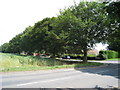
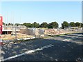
7
Looking NE along Sholden New Road
Deal Hockey club grounds to the right of the picture.
Image: © Nick Smith
Taken: 14 Oct 2007
0.08 miles
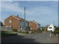
8
Sholden Fields building site
On 15 November 2011, it was reported on the thisiskent website that residents of Sholden had reacted furiously to a Dover District Council’s decision to allow 460 new homes to be built in their village. This shows the site that Ward is building beside the A258 (London Road) and Sholden New Road (marked by the line of trees in this view) http://www.thisiskent.co.uk/Villagers-dismayed-plan-460-homes-Sholden/story-14145753-detail/story.html#axzz2ehS0g3qq
Image: © John Baker
Taken: 27 Aug 2013
0.09 miles
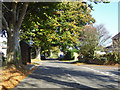
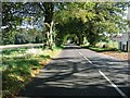
9

Sholden New Road
This road leads from The Street, towards the A258 Sandwich Road.
Image: © David Anstiss
Taken: 17 Apr 2011
0.09 miles