IMAGES TAKEN NEAR TO
Castle Road, SANDWICH, CT13 9JN
Introduction
This page details the photographs taken nearby to Castle Road, CT13 9JN by members of the Geograph project.
The Geograph project started in 2005 with the aim of publishing, organising and preserving representative images for every square kilometre of Great Britain, Ireland and the Isle of Man.

There are currently over 7.5m images from over14,400 individuals and you can help contribute to the project by visiting https://www.geograph.org.uk
Image Map
Images are licensed for reuse under creativecommons.org/licenses/by-sa/2.0
Notes
- Clicking on the map will re-center to the selected point.
- The higher the marker number, the further away the image location is from the centre of the postcode.
Image Listing (120 Images Found)
Images are licensed for reuse under creativecommons.org/licenses/by-sa/2.0
Image
Details
Distance
1
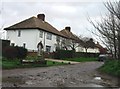
Houses on small lane viewed from Richborough Road.
Image: © Nick Smith
Taken: 9 Jan 2007
0.01 miles
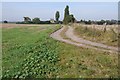
3
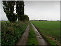
Track leading towards Richborough Castle
Image: © Chris Heaton
Taken: 19 Oct 2013
0.04 miles
4
View across the fields from the car park of Richborough Castle
Image: © Nick Smith
Taken: 29 Mar 2008
0.06 miles
5
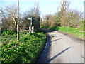
Richborough Road
The footpath on the left leads to the Stour Valley Walk. The view of the footpath from the Stour Valley Walk can be seen at http://www.geograph.org.uk/photo/3814258
Image: © Marathon
Taken: 12 Jan 2014
0.08 miles
6
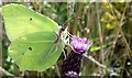
Brimstone butterfly Gonepteryx rhamni, feeding on thistle flower
See https://butterfly-conservation.org/50-1310/brimstone.html for information about the Brimstone butterfly. It is one of the few British butterflies that overwinters. Because of this it can be seen in very early spring before other species have pupated.
Image: © Bikeboy
Taken: 11 Aug 2017
0.09 miles
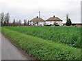
7
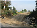
Access to new pipeline laying work near Castle Farm
Image: © Nick Smith
Taken: 21 Sep 2008
0.09 miles
8
Looking SW from Richborough Road
A new pipeline is being laid and this is the access road from Richborough Road
Image: © Nick Smith
Taken: 21 Sep 2008
0.11 miles
9
Watling Street
The start of Watling Street, the Roman Road viewed here at its start at Richborough Fort.
Image: © Philip Halling
Taken: 28 Sep 2014
0.12 miles
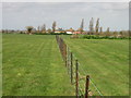
10
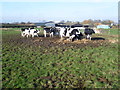
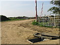
Cattle at Castle Farm
This is the view from a footpath leading from the Stour Valley Walk to Richborough Road. Castle Farm can be seen behind.
Image: © Marathon
Taken: 12 Jan 2014
0.13 miles