IMAGES TAKEN NEAR TO
Gore Lane, SANDWICH, CT13 0LQ
Introduction
This page details the photographs taken nearby to Gore Lane, CT13 0LQ by members of the Geograph project.
The Geograph project started in 2005 with the aim of publishing, organising and preserving representative images for every square kilometre of Great Britain, Ireland and the Isle of Man.

There are currently over 7.5m images from over14,400 individuals and you can help contribute to the project by visiting https://www.geograph.org.uk
Image Map
Images are licensed for reuse under creativecommons.org/licenses/by-sa/2.0
Notes
- Clicking on the map will re-center to the selected point.
- The higher the marker number, the further away the image location is from the centre of the postcode.
Image Listing (52 Images Found)
Images are licensed for reuse under creativecommons.org/licenses/by-sa/2.0
Image
Details
Distance
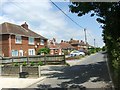
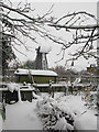
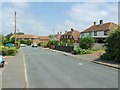
4
Looking towards Eastry from the byway
The fairly new development of Mill Point is on the right of the picture
Image: © Nick Smith
Taken: 3 Nov 2007
0.05 miles
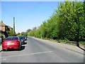
8
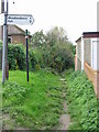
Start of the byway at the end of Mill Lane
Image: © Nick Smith
Taken: 3 Nov 2007
0.07 miles
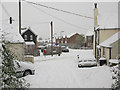
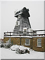
10
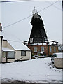
Windmill on Mill Lane, Eastry
A very similar but snowy view to http://www.geograph.org.uk/photo/1385642
Image: © Nick Smith
Taken: 7 Jan 2010
0.08 miles