IMAGES TAKEN NEAR TO
Sandwich Road, SANDWICH, CT13 0EP
Introduction
This page details the photographs taken nearby to Sandwich Road, CT13 0EP by members of the Geograph project.
The Geograph project started in 2005 with the aim of publishing, organising and preserving representative images for every square kilometre of Great Britain, Ireland and the Isle of Man.

There are currently over 7.5m images from over14,400 individuals and you can help contribute to the project by visiting https://www.geograph.org.uk
Image Map
Images are licensed for reuse under creativecommons.org/licenses/by-sa/2.0
Notes
- Clicking on the map will re-center to the selected point.
- The higher the marker number, the further away the image location is from the centre of the postcode.
Image Listing (14 Images Found)
Images are licensed for reuse under creativecommons.org/licenses/by-sa/2.0
Image
Details
Distance

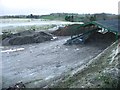
2
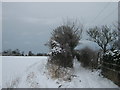
Byway to Eastry
A track leads from Sandwich Road to Gore Lane in Eastry.
Image: © David Anstiss
Taken: 19 Dec 2010
0.04 miles
3
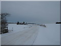
Sandwich Road
This road leads from Hammill towards Chillenden and onwards to Nonington.
Has been cleared by a snow plough, but not salted. Only suitable for 4x4 traffic.
Image: © David Anstiss
Taken: 19 Dec 2010
0.05 miles
5
Continuation of byway towards the Nonington road
The end of the lane shown in Image is on the right of the picture
Image: © Nick Smith
Taken: 3 Nov 2007
0.14 miles
7
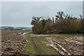
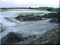
Byway near Hammill Farm
Byway leading west from Eastry, seen here south of Hamill Farm. Following one of the wettest Januaries on record in South East England, the track is extremely muddy.
Image: © Ian Capper
Taken: 25 Jan 2014
0.22 miles
8
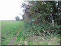
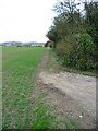
Junction of footpaths
The path on the right leads to Tickenhurst, straight on for Eastry
Image: © Nick Smith
Taken: 3 Nov 2007
0.22 miles
9

View of Pillbox on the hill
As seen from a lane leading towards Upper Rowling Farm,Lower Rowling Farm and Rowling Court.
Image: © David Anstiss
Taken: 19 Dec 2010
0.22 miles
10
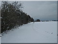
Lane to Hammill Farm
This snow covered lane leads from the Eastry byway.
Image: © David Anstiss
Taken: 19 Dec 2010
0.22 miles