IMAGES TAKEN NEAR TO
Woodnesborough, SANDWICH, CT13 0EN
Introduction
This page details the photographs taken nearby to CT13 0EN by members of the Geograph project.
The Geograph project started in 2005 with the aim of publishing, organising and preserving representative images for every square kilometre of Great Britain, Ireland and the Isle of Man.

There are currently over 7.5m images from over14,400 individuals and you can help contribute to the project by visiting https://www.geograph.org.uk
Image Map
Images are licensed for reuse under creativecommons.org/licenses/by-sa/2.0
Notes
- Clicking on the map will re-center to the selected point.
- The higher the marker number, the further away the image location is from the centre of the postcode.
Image Listing (23 Images Found)
Images are licensed for reuse under creativecommons.org/licenses/by-sa/2.0
Image
Details
Distance
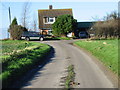
1
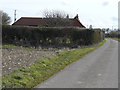
Little Britten, Chalk Pit Lane
Compared with Image, work on the house has been completed. One of the oddities of Ordnance Survey is that Chalk Pit Lane changes to Chalk Pit Hill when one increases the map magnification to its maximum.
Image: © John Baker
Taken: 22 Feb 2015
0.00 miles
2
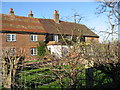
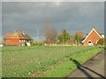
Houses on Chalk Pit lane.
View of houses on NE of Chalk Pit Lane.
Image: © Nick Smith
Taken: 4 Jan 2007
0.02 miles
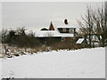
4
Little Britten, Chalk Pit Lane
It appears that the building is having work carried out to its roof due to cover of scaffolding and polythene that has been erected over it to keep out the elements.
Image: © John Baker
Taken: 6 Oct 2013
0.02 miles
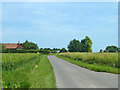
5
View of the houses and farmland on Chalk Pit Lane
Image: © Nick Smith
Taken: 4 Jan 2007
0.02 miles
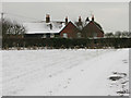
6
Little Britten Farm House from Chalkpit Hill
Image: © Nick Smith
Taken: 7 Jan 2010
0.03 miles
7
House on road junction.
Possibly still Chalk Pit Lane at this point.
Image: © Nick Smith
Taken: 4 Jan 2007
0.03 miles
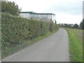
8
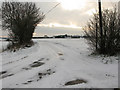
Chalk Pit Lane
From Barnsole towards Hammill.
Image: © Robin Webster
Taken: 12 Jun 2014
0.04 miles
9
Road junction to Summerfield near Little Britten Farmhouse
Image: © Nick Smith
Taken: 7 Jan 2010
0.05 miles
10
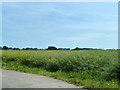
Field of oil seed rape
By Chalk Pit Lane.
Image: © Robin Webster
Taken: 12 Jun 2014
0.10 miles