IMAGES TAKEN NEAR TO
Ozengell Place, RAMSGATE, CT12 6FH
Introduction
This page details the photographs taken nearby to Ozengell Place, CT12 6FH by members of the Geograph project.
The Geograph project started in 2005 with the aim of publishing, organising and preserving representative images for every square kilometre of Great Britain, Ireland and the Isle of Man.

There are currently over 7.5m images from over14,400 individuals and you can help contribute to the project by visiting https://www.geograph.org.uk
Image Map
Images are licensed for reuse under creativecommons.org/licenses/by-sa/2.0
Notes
- Clicking on the map will re-center to the selected point.
- The higher the marker number, the further away the image location is from the centre of the postcode.
Image Listing (16 Images Found)
Images are licensed for reuse under creativecommons.org/licenses/by-sa/2.0
Image
Details
Distance
1
Entrance to the Marlowe Academy from the new A256
Image: © Nick Smith
Taken: 12 Jan 2010
0.08 miles
2
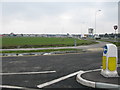
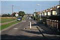
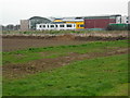
View of the new A256
The old A256 - Haine Road - is still in place with traffic calming but this new road has been built to help traffic flow to the expanding Westwood Cross shopping centre.
Image: © Nick Smith
Taken: 12 Jan 2010
0.10 miles
3
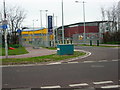
Entrance To The Marlowe Academy
This is the entrance to the new Marlowe Academy, which replaces the Ramsgate School. It also includes the new Newington Library.
Image: © David Mastin
Taken: 18 Feb 2007
0.10 miles
4
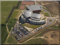
The Marlowe Academy
The Marlowe Academy in Stirling Avenue at the time of completion
Image: © Freddie Smith
Taken: 12 Jun 2007
0.11 miles
5
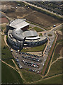
The Marlowe Academy in Stirling Avenue
Newly built and "awaiting the onslaught" The Marlowe Academy in Stirling Avenue nears completion
Image: © Freddie Smith
Taken: 12 Jun 2007
0.11 miles
6
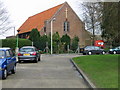
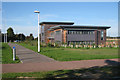
The Marlowe Academy
This is an image of the new Marlow Academy, which opened in September 2006. It was built next to the Ramsgate School which it replaced. The school buildings still to be seen on Ordnance Survey maps are those of the Ramsgate School which were demolished in late 2006.
Image: © David Mastin
Taken: 18 Feb 2007
0.13 miles
7
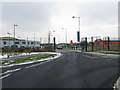
New Offices off Haine Road
Beside Stirling Way.
Image: © Oast House Archive
Taken: 21 Sep 2010
0.14 miles