IMAGES TAKEN NEAR TO
Cheesemans Farm Stables, CT12 5GN
Introduction
This page details the photographs taken nearby to Cheesemans Farm Stables, CT12 5GN by members of the Geograph project.
The Geograph project started in 2005 with the aim of publishing, organising and preserving representative images for every square kilometre of Great Britain, Ireland and the Isle of Man.

There are currently over 7.5m images from over14,400 individuals and you can help contribute to the project by visiting https://www.geograph.org.uk
Image Map
Images are licensed for reuse under creativecommons.org/licenses/by-sa/2.0
Notes
- Clicking on the map will re-center to the selected point.
- The higher the marker number, the further away the image location is from the centre of the postcode.
Image Listing (7 Images Found)
Images are licensed for reuse under creativecommons.org/licenses/by-sa/2.0
Image
Details
Distance
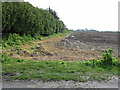
2
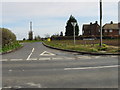
Junction of Woodchurch Road with Manston Road
Image: © Nick Smith
Taken: 24 Mar 2008
0.06 miles
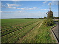
6
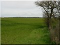
View across the fields from Alland Grange Lane
The white top of Waterloo Tower http://www.geograph.org.uk/photo/739196 is just about visible in the centre of the photo, amongst the trees
Image: © Nick Smith
Taken: 24 Mar 2008
0.23 miles
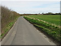
7
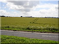
View across cornfield
Looking SSW across cornfield of Cheesemans Farm
Image: © D-G-Seamon
Taken: 21 Jun 2007
0.24 miles