IMAGES TAKEN NEAR TO
High Street, RAMSGATE, CT12 5BQ
Introduction
This page details the photographs taken nearby to High Street, CT12 5BQ by members of the Geograph project.
The Geograph project started in 2005 with the aim of publishing, organising and preserving representative images for every square kilometre of Great Britain, Ireland and the Isle of Man.

There are currently over 7.5m images from over14,400 individuals and you can help contribute to the project by visiting https://www.geograph.org.uk
Image Map
Images are licensed for reuse under creativecommons.org/licenses/by-sa/2.0
Notes
- Clicking on the map will re-center to the selected point.
- The higher the marker number, the further away the image location is from the centre of the postcode.
Image Listing (51 Images Found)
Images are licensed for reuse under creativecommons.org/licenses/by-sa/2.0
Image
Details
Distance
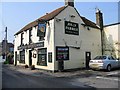
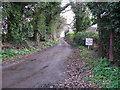
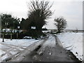
1
View along minor road to the High Street, Manston
Manston Methodist chapel is on the left.
Image: © Nick Smith
Taken: 12 Jan 2010
0.03 miles
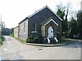
4
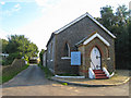
Manston Methodist chapel
On High Street.
Image: © Oast House Archive
Taken: 17 Sep 2010
0.03 miles
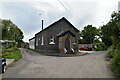
6
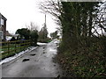
View along the southern end of High Street, Manston
Image: © Nick Smith
Taken: 12 Jan 2010
0.05 miles
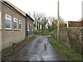
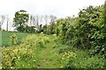
7
Bridleway and private road to Whitebeams
Image: © Nick Smith
Taken: 12 Jan 2010
0.06 miles
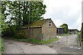
9
Willowbank Nurseries at southern end of High Street
Image: © Nick Smith
Taken: 12 Jan 2010
0.09 miles