IMAGES TAKEN NEAR TO
Conyngham Road, RAMSGATE, CT12 4HA
Introduction
This page details the photographs taken nearby to Conyngham Road, CT12 4HA by members of the Geograph project.
The Geograph project started in 2005 with the aim of publishing, organising and preserving representative images for every square kilometre of Great Britain, Ireland and the Isle of Man.

There are currently over 7.5m images from over14,400 individuals and you can help contribute to the project by visiting https://www.geograph.org.uk
Image Map
Images are licensed for reuse under creativecommons.org/licenses/by-sa/2.0
Notes
- Clicking on the map will re-center to the selected point.
- The higher the marker number, the further away the image location is from the centre of the postcode.
Image Listing (190 Images Found)
Images are licensed for reuse under creativecommons.org/licenses/by-sa/2.0
Image
Details
Distance
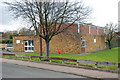
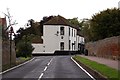
2
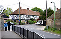
The entrance to Durlock,Minster, Thanet, Kent
This view was taken from just inside Church Street which starts near road sign on the righthand side of the road.
Bedlam Court Lane starts just past the junction with Durlock.
Image: © david mills
Taken: 3 May 2007
0.03 miles