IMAGES TAKEN NEAR TO
St. Augustines Road, CANTERBURY, CT1 1XR
Introduction
This page details the photographs taken nearby to St. Augustines Road, CT1 1XR by members of the Geograph project.
The Geograph project started in 2005 with the aim of publishing, organising and preserving representative images for every square kilometre of Great Britain, Ireland and the Isle of Man.

There are currently over 7.5m images from over14,400 individuals and you can help contribute to the project by visiting https://www.geograph.org.uk
Image Map
Images are licensed for reuse under creativecommons.org/licenses/by-sa/2.0
Notes
- Clicking on the map will re-center to the selected point.
- The higher the marker number, the further away the image location is from the centre of the postcode.
Image Listing (79 Images Found)
Images are licensed for reuse under creativecommons.org/licenses/by-sa/2.0
Image
Details
Distance
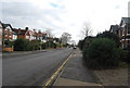
3
The North Downs Way heads towards Canterbury
The long distance path and the Elham Valley Way (another path) head towards Pilgrim's Way and onto Canterbury City centre.
Image: © David Anstiss
Taken: 26 Mar 2010
0.06 miles
4
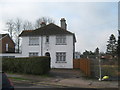
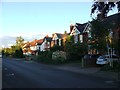
Pilgrim's Lodge
A retirement home for 'ladies' and 'gentlemen of Canterbury. On the Pilgrim's Way.
Image: © David Anstiss
Taken: 26 Mar 2010
0.07 miles
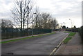
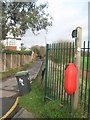
7
The North Downs Way on the Pilgrim's Way in Canterbury
The long distance path (and the Elham Valley Way) turn here to head straight on towards another section of the Pilgrim's Way. The paths also head left on a byway towards Spring Lane and onwards to the city centre.
Image: © David Anstiss
Taken: 26 Mar 2010
0.09 miles
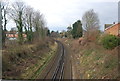
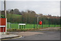
9
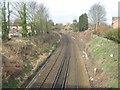
Railway to Canterbury
As seen from Image This line leads from Dover via stations to Bekesbourne and then onto Canterbury East.
Image: © David Anstiss
Taken: 26 Mar 2010
0.11 miles
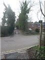
10
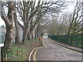
The Pilgrim's Way towards Spring Lane
This road is also part of the North Downs Way and Elham Valley Way (long distance paths) heading towards St.Martins Hill and onto Canterbury Cathedral in the city centre.
Image: © David Anstiss
Taken: 26 Mar 2010
0.12 miles