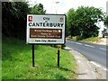
IMAGES TAKEN NEAR TO
Villiers Road, CANTERBURY, CT1 1TJ
Introduction
This page details the photographs taken nearby to Villiers Road, CT1 1TJ by members of the Geograph project.
The Geograph project started in 2005 with the aim of publishing, organising and preserving representative images for every square kilometre of Great Britain, Ireland and the Isle of Man.

There are currently over 7.5m images from over14,400 individuals and you can help contribute to the project by visiting https://www.geograph.org.uk
Image Map
Images are licensed for reuse under creativecommons.org/licenses/by-sa/2.0
Notes
- Clicking on the map will re-center to the selected point.
- The higher the marker number, the further away the image location is from the centre of the postcode.
Image Listing (23 Images Found)
Images are licensed for reuse under creativecommons.org/licenses/by-sa/2.0
Image
Details
Distance
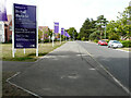
1
Former Telephone Engineering Centre, Villiers Road
Planning permission has been granted by Canterbury City Council under application number CA//12/01184 for an “outline application for the redevelopment of the site to provide 93 dwellings, access, estate roads, landscaping, public open space and play area".
After completion, the development was named Image
Image: © John Baker
Taken: 6 Oct 2013
0.01 miles
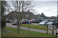
2
The entrance to Canterbury Golf Club on Littlebourne Road
Image: © David Howard
Taken: 21 Mar 2020
0.02 miles
3
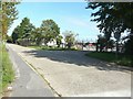
Villiers Road
The development, which has been named Royal Parade, consists of an assortment of apartments and houses, which were built on the site of a Image
Image: © John Baker
Taken: 28 Aug 2022
0.03 miles
4
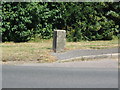
Boundary stone, A257
Marked with the government 'broad arrow' and 'BS WD No. 9'. At the SE end of the barracks on the A257.
Image: © E Gammie
Taken: 8 Jul 2010
0.03 miles
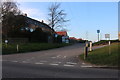
5
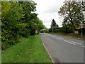
A257 leaving Canterbury
The road heading east towards Sandwich
Image: © Chris Heaton
Taken: 20 Oct 2013
0.04 miles
8
Entrance to Bekesbourne Lane from the A257
Image: © Nick Smith
Taken: 23 Dec 2007
0.10 miles
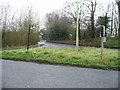
9
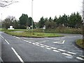
Junction of Bekesbourne Lane with the A257
The entrance to Canterbury golf club can be seen in the trees opposite the junction.
Image: © Nick Smith
Taken: 23 Dec 2007
0.10 miles
10
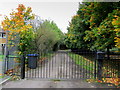
Gated Entrance to Old Park Farm
The end of Villiers Road is barred by a gate, forcing walkers onto rough ground parallel to a barbed wire fence.
Image: © Chris Heaton
Taken: 20 Oct 2013
0.11 miles