IMAGES TAKEN NEAR TO
Edgar Road, CANTERBURY, CT1 1NR
Introduction
This page details the photographs taken nearby to Edgar Road, CT1 1NR by members of the Geograph project.
The Geograph project started in 2005 with the aim of publishing, organising and preserving representative images for every square kilometre of Great Britain, Ireland and the Isle of Man.

There are currently over 7.5m images from over14,400 individuals and you can help contribute to the project by visiting https://www.geograph.org.uk
Image Map
Images are licensed for reuse under creativecommons.org/licenses/by-sa/2.0
Notes
- Clicking on the map will re-center to the selected point.
- The higher the marker number, the further away the image location is from the centre of the postcode.
Image Listing (313 Images Found)
Images are licensed for reuse under creativecommons.org/licenses/by-sa/2.0
Image
Details
Distance
9
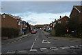
North Holmes Road, Canterbury
A view eastwards from outside the entrance to Christ Church University (right).
The St George flag is being flown by a householder in support of the England football team in the 2010 South Africa World Cup.
A woman on the left of the picture is striding purposefully into a strong wind (as evidenced by the large tree, right)
Image: © Stephen Craven
Taken: 17 Jun 2010
0.08 miles