IMAGES TAKEN NEAR TO
Chaucer Road, CANTERBURY, CT1 1JT
Introduction
This page details the photographs taken nearby to Chaucer Road, CT1 1JT by members of the Geograph project.
The Geograph project started in 2005 with the aim of publishing, organising and preserving representative images for every square kilometre of Great Britain, Ireland and the Isle of Man.

There are currently over 7.5m images from over14,400 individuals and you can help contribute to the project by visiting https://www.geograph.org.uk
Image Map
Images are licensed for reuse under creativecommons.org/licenses/by-sa/2.0
Notes
- Clicking on the map will re-center to the selected point.
- The higher the marker number, the further away the image location is from the centre of the postcode.
Image Listing (38 Images Found)
Images are licensed for reuse under creativecommons.org/licenses/by-sa/2.0
Image
Details
Distance
1
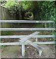
Stile and footpath
The path leads to King's Park.
Image: © DS Pugh
Taken: 20 Aug 2019
0.06 miles
2
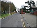
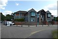
Chaucer Road, no public access beyond this point
Image: © Nick Smith
Taken: 31 Dec 2007
0.10 miles
4
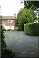
King's Park
Seen as a footpath emerges into the street.
Image: © DS Pugh
Taken: 20 Aug 2019
0.11 miles
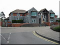
7
Buffs Road
A similar view of this part of Image was taken in December 2022 before the houses, lining the road, appeared to have been completed. New houses are now under construction on this development, which has been named Grand Parade.
Image: © John Baker
Taken: 23 Jul 2023
0.15 miles
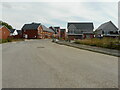
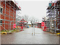
8
Queens Drive
The road forms a junction with Buffs Road and is part of a development, which has been named Grand Parade.
Image: © John Baker
Taken: 23 Jul 2023
0.15 miles
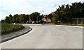
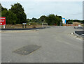
9
Unnamed road
It forms a junction with Buffs Road. The development has been named Royal Parade.
Taken during a photographic outing on Christmas Day afternoon.
Image: © John Baker
Taken: 25 Dec 2022
0.15 miles
10
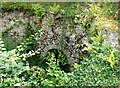
St. Augustine's Conduit House, Canterbury
Situated off King's Park. Belonging to English Heritage, this site is neglected and overgrown so that not much is still visible. It dates from the mid-12th century. A roughly octagonal masonry tank is now divided by an 18th century chalk and brick wall. Four tunnelled openings and three smaller ducts, which collect water from springs, lead into the tank. Water was delivered from here to the abbey by a lead pipe running from the western side of the structure. The pipe may have led to a water tower at the abbey, which would have fed smaller tanks in the kitchen, infirmary and other parts of the monastic complex.
Image: © pam fray
Taken: 27 Jul 2022
0.15 miles