IMAGES TAKEN NEAR TO
Winston Close, CANTERBURY, CT1 1FA
Introduction
This page details the photographs taken nearby to Winston Close, CT1 1FA by members of the Geograph project.
The Geograph project started in 2005 with the aim of publishing, organising and preserving representative images for every square kilometre of Great Britain, Ireland and the Isle of Man.

There are currently over 7.5m images from over14,400 individuals and you can help contribute to the project by visiting https://www.geograph.org.uk
Image Map
Images are licensed for reuse under creativecommons.org/licenses/by-sa/2.0
Notes
- Clicking on the map will re-center to the selected point.
- The higher the marker number, the further away the image location is from the centre of the postcode.
Image Listing (47 Images Found)
Images are licensed for reuse under creativecommons.org/licenses/by-sa/2.0
Image
Details
Distance
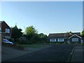
1
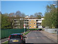
Pilgrims Road
Approaching junction with Spring Lane.
Image: © Oast House Archive
Taken: 8 Apr 2011
0.08 miles
2
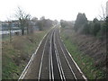
Railway to Bekesbourne
As seen from Image This line heads from Canterbury towards Bekesbourne and then onwards to Dover.
Image: © David Anstiss
Taken: 26 Mar 2010
0.13 miles
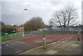
6
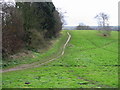
Unofficial footpath on St Martin's Hill
This area of grassland lies between the A257 St Martin's Hill and Spring Lane. No footpath is marked on the map but it is clearly well used.
Image: © Nick Smith
Taken: 31 Dec 2007
0.15 miles
7
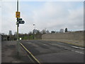
North Downs Way and Elham Valley Way on Pilgrims' Way road bridge
The road heads over the Canterbury to Dover Railway Line. The long distance paths head from Canterbury towards Patrixbourne.
Image: © David Anstiss
Taken: 26 Mar 2010
0.15 miles
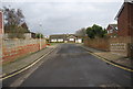
9
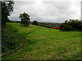
Open Space in St. Martin's, Canterbury
A sweeping area of open ground seen from the A257, to the east of Canterbury.
Image: © Chris Heaton
Taken: 20 Oct 2013
0.16 miles
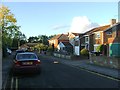
10
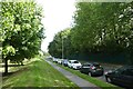
Spring Lane
Looking along Spring Lane from the edge of the common.
Image: © DS Pugh
Taken: 20 Aug 2019
0.16 miles