IMAGES TAKEN NEAR TO
St. Lukes Avenue, RAMSGATE, CT11 7JY
Introduction
This page details the photographs taken nearby to St. Lukes Avenue, CT11 7JY by members of the Geograph project.
The Geograph project started in 2005 with the aim of publishing, organising and preserving representative images for every square kilometre of Great Britain, Ireland and the Isle of Man.

There are currently over 7.5m images from over14,400 individuals and you can help contribute to the project by visiting https://www.geograph.org.uk
Image Map
Images are licensed for reuse under creativecommons.org/licenses/by-sa/2.0
Notes
- Clicking on the map will re-center to the selected point.
- The higher the marker number, the further away the image location is from the centre of the postcode.
Image Listing (88 Images Found)
Images are licensed for reuse under creativecommons.org/licenses/by-sa/2.0
Image
Details
Distance
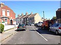
3
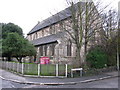
St Luke's church on St Luke's Avenue
At the junction with Hollicondane Road.
Image: © Nick Smith
Taken: 13 Dec 2009
0.09 miles
4
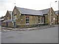
Artwise Youth Arts Centre, St Lukes Avenue
Image: © Nick Smith
Taken: 13 Dec 2009
0.10 miles
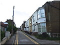
7
View along Holly Road from St Luke's Avenue
Image: © Nick Smith
Taken: 13 Dec 2009
0.11 miles

10
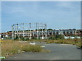
Disused Gas Works Site, Ramsgate
Situated on Boundary Road (A255).
Image: © John Smitten
Taken: 23 Jul 2004
0.13 miles