IMAGES TAKEN NEAR TO
Ashburnham Road, RAMSGATE, CT11 0BJ
Introduction
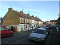
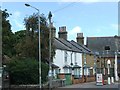
This page details the photographs taken nearby to Ashburnham Road, CT11 0BJ by members of the Geograph project.
The Geograph project started in 2005 with the aim of publishing, organising and preserving representative images for every square kilometre of Great Britain, Ireland and the Isle of Man.

There are currently over 7.5m images from over14,400 individuals and you can help contribute to the project by visiting https://www.geograph.org.uk
Image Map
Images are licensed for reuse under creativecommons.org/licenses/by-sa/2.0
Notes
- Clicking on the map will re-center to the selected point.
- The higher the marker number, the further away the image location is from the centre of the postcode.
Image Listing (74 Images Found)
Images are licensed for reuse under creativecommons.org/licenses/by-sa/2.0
Image
Details
Distance

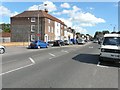
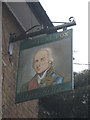
3
Southwood Tavern, Southwood Road, Ramsgate
Now closed.
Image: © Oast House Archive
Taken: 27 Jun 2009
0.06 miles
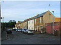
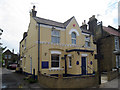
5
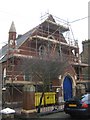
Chapel undergoing renovation
This small chapel on Chapel Road is undergoing renovation works, presumably to convert it into a private house.
Image: © David Anstiss
Taken: 6 Feb 2011
0.08 miles