IMAGES TAKEN NEAR TO
Grant Close, BROADSTAIRS, CT10 2UH
Introduction
This page details the photographs taken nearby to Grant Close, CT10 2UH by members of the Geograph project.
The Geograph project started in 2005 with the aim of publishing, organising and preserving representative images for every square kilometre of Great Britain, Ireland and the Isle of Man.

There are currently over 7.5m images from over14,400 individuals and you can help contribute to the project by visiting https://www.geograph.org.uk
Image Map
Images are licensed for reuse under creativecommons.org/licenses/by-sa/2.0
Notes
- Clicking on the map will re-center to the selected point.
- The higher the marker number, the further away the image location is from the centre of the postcode.
Image Listing (43 Images Found)
Images are licensed for reuse under creativecommons.org/licenses/by-sa/2.0
Image
Details
Distance
4
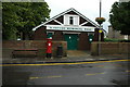
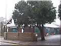
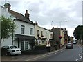
St Peter's Memorial Hall
St Peter's Memorial Hall stands on St Peter's Road in St Peter's near Broadstairs.
Image: © Philip Halling
Taken: 19 Jul 2009
0.08 miles
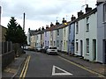
5
St. Peter's Memorial Hall
On St.Peter's High Street.
Image: © David Anstiss
Taken: 20 Feb 2011
0.09 miles
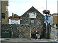
6
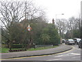
St. Peter's Village Sign
On the junction of Hopeville Avenue (heading left) and Vicarage Street (on the right).
Image: © David Anstiss
Taken: 20 Feb 2011
0.09 miles
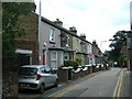
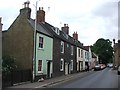
8
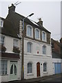
Kent House, Broadstairs
Large town house on St.Peter's High Street.
Image: © David Anstiss
Taken: 20 Feb 2011
0.09 miles
10
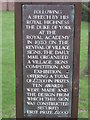
Plaque of St.Peter's Village Sign Post
As seen in Image
Image: © David Anstiss
Taken: 20 Feb 2011
0.11 miles