IMAGES TAKEN NEAR TO
Fairfield Park, BROADSTAIRS, CT10 2JT
Introduction
This page details the photographs taken nearby to Fairfield Park, CT10 2JT by members of the Geograph project.
The Geograph project started in 2005 with the aim of publishing, organising and preserving representative images for every square kilometre of Great Britain, Ireland and the Isle of Man.

There are currently over 7.5m images from over14,400 individuals and you can help contribute to the project by visiting https://www.geograph.org.uk
Image Map
Images are licensed for reuse under creativecommons.org/licenses/by-sa/2.0
Notes
- Clicking on the map will re-center to the selected point.
- The higher the marker number, the further away the image location is from the centre of the postcode.
Image Listing (13 Images Found)
Images are licensed for reuse under creativecommons.org/licenses/by-sa/2.0
Image
Details
Distance
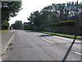
6
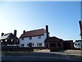
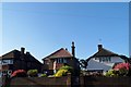
Oaklands Avenue, St Peter's, Broadstairs
The old village of St Peter's is now joined to the Broadstairs conurbation by the usual sort of 20th century development.
Image: © Des Blenkinsopp
Taken: 11 Aug 2017
0.21 miles
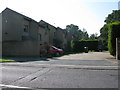
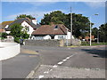
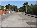
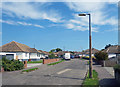
7
Houses on Broadstairs Road, St Peter's
Image: © David Howard
Taken: 30 Jun 2018
0.22 miles
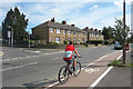
8
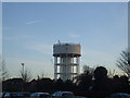
Broadstairs Water Tower
Taken from inside the local ASDA car park.
Image: © Phillip Perry
Taken: 11 Jan 2009
0.22 miles