IMAGES TAKEN NEAR TO
St. Peters Park Road, BROADSTAIRS, CT10 2BG
Introduction
This page details the photographs taken nearby to St. Peters Park Road, CT10 2BG by members of the Geograph project.
The Geograph project started in 2005 with the aim of publishing, organising and preserving representative images for every square kilometre of Great Britain, Ireland and the Isle of Man.

There are currently over 7.5m images from over14,400 individuals and you can help contribute to the project by visiting https://www.geograph.org.uk
Image Map
Images are licensed for reuse under creativecommons.org/licenses/by-sa/2.0
Notes
- Clicking on the map will re-center to the selected point.
- The higher the marker number, the further away the image location is from the centre of the postcode.
Image Listing (128 Images Found)
Images are licensed for reuse under creativecommons.org/licenses/by-sa/2.0
Image
Details
Distance
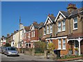
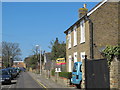
4
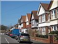
St. Peter's Park Road / Ethel Road, CT10
Image: © Mike Quinn
Taken: 23 Apr 2013
0.06 miles
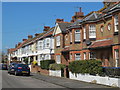
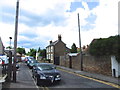
5
Fordoun Road, CT10
Can't help wondering why this residential street in Broadstairs is named after a small village in Aberdeenshire [which, according to the Wiki entry http://en.wikipedia.org/wiki/Fordoun has some interesting "Notable people"].
Image: © Mike Quinn
Taken: 23 Apr 2013
0.06 miles
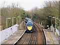
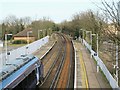
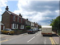
10
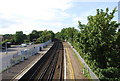
Looking north along the tracks, Broadstairs Station
Image: © N Chadwick
Taken: 4 Jul 2009
0.08 miles