
IMAGES TAKEN NEAR TO
The Mount, WARLINGHAM, CR6 9JF
Introduction
This page details the photographs taken nearby to The Mount, CR6 9JF by members of the Geograph project.
The Geograph project started in 2005 with the aim of publishing, organising and preserving representative images for every square kilometre of Great Britain, Ireland and the Isle of Man.

There are currently over 7.5m images from over14,400 individuals and you can help contribute to the project by visiting https://www.geograph.org.uk
Image Map
Images are licensed for reuse under creativecommons.org/licenses/by-sa/2.0
Notes
- Clicking on the map will re-center to the selected point.
- The higher the marker number, the further away the image location is from the centre of the postcode.
Image Listing (54 Images Found)
Images are licensed for reuse under creativecommons.org/licenses/by-sa/2.0
Image
Details
Distance
1
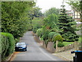
Westview Road
As seen from half-way along the road.
This road leads from Southview Road to The Mount.
Image: © David Anstiss
Taken: 6 Sep 2014
0.10 miles
2
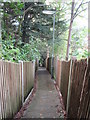
Jacob's Ladder path
This path leads down from Westview Road to Southview Road.
It is mostly steps, lost count after 200, going down !
Image: © David Anstiss
Taken: 6 Sep 2014
0.13 miles
3
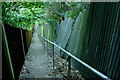
Jacob's Ladder, Warlingham
Warlingham footpath 58 looking rather cold on a lovely spring morning; but the sunshine is blocked by the steep valley side the steps are descending.
Image: © Derek Harper
Taken: 26 Apr 2022
0.13 miles
4
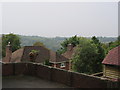
House roofs beside Westhall Road
Looking down the valleyside towards Whyteleafe.
Image: © David Anstiss
Taken: 6 Sep 2014
0.13 miles
5
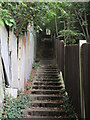
Jacob's Ladder going up
This path leads up from Southview Road (near the railway bridge) up to Westview Road.
It is mostly lots and lots of steps, lost count after 200, going down.
Would not to go up it!
Image: © David Anstiss
Taken: 6 Sep 2014
0.14 miles
6
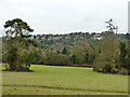
View north-west from Manor Park, Whyteleafe
Image: © Robin Webster
Taken: 24 Jan 2011
0.14 miles
7
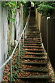
The 39+ Steps
It was a large + and I probably should have counted. There were a further twenty or so steps behind the photographer.
Image: © Peter Trimming
Taken: 26 Sep 2020
0.14 miles
9
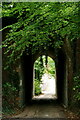
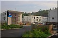
Well Farm Road
Narrow lane under a bridge carrying the railway line from Oxted to London.
Image: © Peter Trimming
Taken: 26 Sep 2020
0.16 miles
10
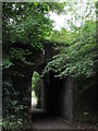
Railway bridge over Southview Road.
This bridge carries the railway line between London Bridge or Victoria and East Grinstead or Uckfield. The Caterham line runs on the other side of the A22 main road.
Image: © David Anstiss
Taken: 6 Sep 2014
0.16 miles