
IMAGES TAKEN NEAR TO
Limpsfield Road, WARLINGHAM, CR6 9DX
Introduction
This page details the photographs taken nearby to Limpsfield Road, CR6 9DX by members of the Geograph project.
The Geograph project started in 2005 with the aim of publishing, organising and preserving representative images for every square kilometre of Great Britain, Ireland and the Isle of Man.

There are currently over 7.5m images from over14,400 individuals and you can help contribute to the project by visiting https://www.geograph.org.uk
Image Map
Images are licensed for reuse under creativecommons.org/licenses/by-sa/2.0
Notes
- Clicking on the map will re-center to the selected point.
- The higher the marker number, the further away the image location is from the centre of the postcode.
Image Listing (23 Images Found)
Images are licensed for reuse under creativecommons.org/licenses/by-sa/2.0
Image
Details
Distance
1
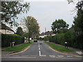
Blanchman's Road
Leading of Limpsfield Road, towards Farm Road.
Image: © David Anstiss
Taken: 6 Sep 2014
0.04 miles
2
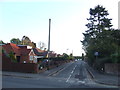
Birch Way, Warlingham
Birch Way is a residential road in Warlingham, Surrey. The blue sign indicates that it is a cul-de-sac.
Image: © Malc McDonald
Taken: 23 Oct 2011
0.11 miles
3
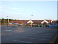
Sainsbury's, Warlingham
Sainsbury's supermarket in Warlingham, Surrey.
The supermarket is built on the site of a bus garage which closed in 1990. A photo of the bus garage is here: Image
The car park is empty, indicating that the supermarket had closed for the day when this photo was taken.
Image: © Malc McDonald
Taken: 23 Oct 2011
0.13 miles
4
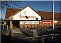
Sainsbury's, Warlingham
Another view of Image A reminder of the Chelsham bus garage which stood here is that the 403 service terminates here.
Image: © Derek Harper
Taken: 9 Dec 2011
0.14 miles
5

Coal tax post, Warlingham
Described at http://www.exploringsurreyspast.org.uk/getRecord?identifier=SHHER_11152 . It stands beside Image, and was relocated here in July 1994; previously it was at the corner of Limpsfield Road and Chelsham Road,http://website.lineone.net/~alan.c.edwards/demcm.html .
Image: © Derek Harper
Taken: 9 Dec 2011
0.14 miles
6
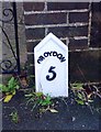
Old Milepost by the B269, Limpsfield Road, Warlingham
Cast iron post by the B269, in parish of WARLINGHAM (TANDRIDGE District), by No. 630 Limpsfield Road, South end of Warlingham, opposite Sainsbury's, back of pavement against brick gate pillar, on South side of road. Croydon gable iron plate, erected by the Limpsfield turnpike trust in the 19th century.
Inscription reads:-
CROYDON
5
(?)
IRON
FOUNDRY
Milestone Society National ID: SY_CYLF05.
Image: © JS Payne
Taken: 1 Oct 2007
0.15 miles
7
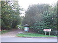
Blanchards Farm nature reserve, Warlingham
An entrance to Blanchards Farm local nature reserve in Warlingham, Surrey.
Image: © Malc McDonald
Taken: 23 Oct 2011
0.16 miles
8
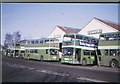
Buses outside former Chelsham bus garage
London Country AN class buses stand outside Chelsham bus garage (near Warlingham, Surrey). This was a former London Transport Country Area bus garage and it closed in 1990. The site is now a Sainsbury's Superstore, thus all evidence of the bus garage has long gone.
Image: © JOHN PARKIN
Taken: Unknown
0.17 miles
9
Roundabout on Limpsfield Road, Warlingham
Image: © David Howard
Taken: 15 Apr 2012
0.18 miles
10
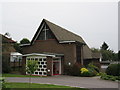
Warlingham Methodist Church
On Limpsfield Road.
Image: © David Anstiss
Taken: 6 Sep 2014
0.20 miles