
IMAGES TAKEN NEAR TO
Chipstead Lane, COULSDON, CR5 3SQ
Introduction
This page details the photographs taken nearby to Chipstead Lane, CR5 3SQ by members of the Geograph project.
The Geograph project started in 2005 with the aim of publishing, organising and preserving representative images for every square kilometre of Great Britain, Ireland and the Isle of Man.

There are currently over 7.5m images from over14,400 individuals and you can help contribute to the project by visiting https://www.geograph.org.uk
Image Map
Images are licensed for reuse under creativecommons.org/licenses/by-sa/2.0
Notes
- Clicking on the map will re-center to the selected point.
- The higher the marker number, the further away the image location is from the centre of the postcode.
Image Listing (19 Images Found)
Images are licensed for reuse under creativecommons.org/licenses/by-sa/2.0
Image
Details
Distance
1
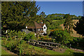
The Well House Inn
Originally three cottages, dating from the 16th century, they became a tearoom in the early 20th century, before being converted to a pub by Bass in 1955. Grade II listed - for listing particulars see www.historicengland.org.uk/listing/the-list/list-entry/1377994.
Image: © Ian Capper
Taken: 23 May 2010
0.00 miles
2
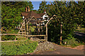
The Well House Inn
Originally three cottages, dating from the 16th century, they became a tearoom in the early 20th century, before being converted to a pub by Bass in 1955. Grade II listed - for listing particulars see www.historicengland.org.uk/listing/the-list/list-entry/1377994.
Image: © Ian Capper
Taken: 23 May 2010
0.00 miles
3
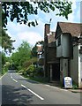
The Well House Inn
The Well House Inn.
Image: © The Saunterer
Taken: 29 May 2012
0.01 miles
4
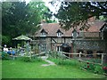
The Well
The well at the rear of The Well House Inn.
Image: © The Saunterer
Taken: 29 May 2012
0.01 miles
5
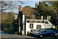
The Well House Inn, Mugswell
The Well House Inn is named after the main feature of the gardens, St. Margaret's Well. The well is apparently mentioned in the Domesday Book of 1086. It is still actively used to this day The Environment Agency constantly monitor the level of water in the well and we understand from them that it is the primary monitoring site for the whole of South London and the south-east of England.
The buildings which make up the present pub, originally three cottages, are believed to date from the mid 1560s.
During the first half of the last century the buildings became tea rooms. In 1955 Bass bought the property and converted it into a public house.
Image: © John Hilton
Taken: 12 Mar 2000
0.01 miles
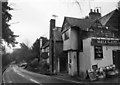
7
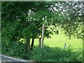
Footpath
Footpath 47 crossing Chipstead Lane at The Well House Inn.
Image: © The Saunterer
Taken: 29 May 2012
0.01 miles
8
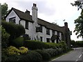
Well House Inn
The Well House Inn on Chipstead Lane dates back to the 14th Century. Its garden contains a 100 ft deep well known as St Margaret's Well (or Mag's Well) and is the source of the name of nearby Muggswell. The well is mentioned in the Domesday Book.
Image: © Hywel Williams
Taken: 14 Jun 2005
0.05 miles
9

Chipstead Lane
Looking west from near the Well House Inn.
Image: © Ian Capper
Taken: 23 May 2010
0.06 miles
10
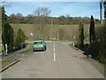
Monkswell Lane looking towards Smugglers Pit Plantation
View from Monkswell Lane showing junction with Chipstead Lane and Smugglers Pit Plantation on the skyline.
Image: © John Hilton
Taken: 11 Mar 2007
0.16 miles