
IMAGES TAKEN NEAR TO
Church Lane Drive, COULSDON, CR5 3RG
Introduction
This page details the photographs taken nearby to Church Lane Drive, CR5 3RG by members of the Geograph project.
The Geograph project started in 2005 with the aim of publishing, organising and preserving representative images for every square kilometre of Great Britain, Ireland and the Isle of Man.

There are currently over 7.5m images from over14,400 individuals and you can help contribute to the project by visiting https://www.geograph.org.uk
Image Map
Images are licensed for reuse under creativecommons.org/licenses/by-sa/2.0
Notes
- Clicking on the map will re-center to the selected point.
- The higher the marker number, the further away the image location is from the centre of the postcode.
Image Listing (90 Images Found)
Images are licensed for reuse under creativecommons.org/licenses/by-sa/2.0
Image
Details
Distance
1
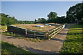
The Orchard
Roof of The Orchard, a new church hall for St Margaret's Church, Chisptead, half buried in the hillside, opened in September 2012.
Image: © Ian Capper
Taken: 8 Jul 2013
0.12 miles
3
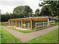
The Orchard at St Margaret's
As another contributor points out Image this ancillary building in the churchyard, which sits exactly on the 150m contour, was opened in 2012 under the title "The Orchard". The working title of the project in its earlier phases had been "Junior Church Building". The architects were Brewer Jewel of Dorking.
The half-buried building with its "green" roof proved a more acceptable plan to local planners and church authorities than extending the mediaeval church itself Image Part of the churchyard (which had not yet been used for burials) was set aside, deconsecrated and ownership transferred to the Parochial Church Council for the purpose.
Image: © Stephen Craven
Taken: 5 Oct 2013
0.12 miles
4
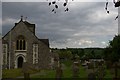
Chipstead church
The ancient parish church of Chipstead is high on the Downs some way from the modern commuter settlement of the same name, which has grown around the railway in the valley.
The tower of the former Netherne mental hospital, most of the site of which is now given over to housing, can be seen on the horizon to the right of the church.
Image: © Christopher Hilton
Taken: 18 May 2008
0.13 miles
5
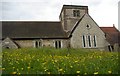
Chipstead church
The ancient parish church of Chipstead is high on the Downs some way from the modern commuter settlement of the same name, which has grown around the railway in the valley.
Image: © Christopher Hilton
Taken: 18 May 2008
0.13 miles
6
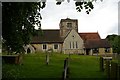
Chipstead church
The ancient parish church of Chipstead is high on the Downs some way from the modern commuter settlement of the same name, which has grown around the railway in the valley.
Image: © Christopher Hilton
Taken: 18 May 2008
0.13 miles
7
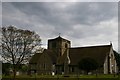
Chipstead church
The ancient parish church of Chipstead is high on the Downs some way from the modern commuter settlement of the same name, which has grown around the railway in the valley.
Image: © Christopher Hilton
Taken: 18 May 2008
0.13 miles
8
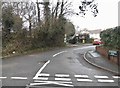
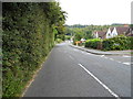
St Margaret's Road, Hooley
You can just see a pre-Worboys sign with the stripy pole taken close here http://www.geograph.org.uk/photo/3122912
Image: © David Howard
Taken: 24 Jan 2016
0.13 miles
9
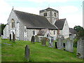
St.Margaret's Church, Chipstead
In my view, the most imposing angle.
Image: © Peter Trimming
Taken: 4 Sep 2007
0.13 miles
10
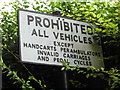
Pre-Worboys sign on St Margaret's Road, Hooley
I have a picture of this already (including the stripy pole) but this is not covered in foliage over one corner.
Image: © David Howard
Taken: 9 Sep 2012
0.13 miles