
IMAGES TAKEN NEAR TO
Hazelwood Lane, COULSDON, CR5 3PF
Introduction
This page details the photographs taken nearby to Hazelwood Lane, CR5 3PF by members of the Geograph project.
The Geograph project started in 2005 with the aim of publishing, organising and preserving representative images for every square kilometre of Great Britain, Ireland and the Isle of Man.

There are currently over 7.5m images from over14,400 individuals and you can help contribute to the project by visiting https://www.geograph.org.uk
Image Map
Images are licensed for reuse under creativecommons.org/licenses/by-sa/2.0
Notes
- Clicking on the map will re-center to the selected point.
- The higher the marker number, the further away the image location is from the centre of the postcode.
Image Listing (70 Images Found)
Images are licensed for reuse under creativecommons.org/licenses/by-sa/2.0
Image
Details
Distance
1
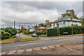
Stagbury Avenue
Road off Hazelwood Lane, shown as laid out (but with only three houses at that stage) on the 1935 1:2,500 map.
Image: © Ian Capper
Taken: 27 Oct 2018
0.05 miles
2
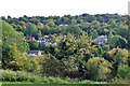
Trees and houses, Chipstead Valley
Somewhere down in the bottom is Outwood Lane, feeding the residential roads climbing the valley side.
Image: © Robin Webster
Taken: 6 Oct 2010
0.05 miles
3

Railway near Chipstead
A view of the railway with a train approaching Chipstead station in north Surrey. Chipstead is on a branch line from Purley to Tattenham Corner.
The train is a Class 377 electric multiple unit (EMU), it draws power from the third rail. The train's tail lights appear very bright, as this image was taken in poor light on a dull January afternoon.
Image: © Malc McDonald
Taken: 11 Jan 2020
0.06 miles
4

Railway heading north towards Chipstead Station
From the bridge on Hazelwood Lane.
Image: © JThomas
Taken: 31 Mar 2025
0.08 miles
5
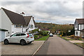
Stagbury Close
Cul-de-sac off Hazelwood Lane, shown as laid out (but with only one house at that stage) on the 1935 1:2,500 map.
Image: © Ian Capper
Taken: 27 Oct 2018
0.10 miles
6
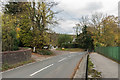
Hazelwood Lane
Looking along Hazelwood Lane from the bridge over the railway to Tattenham Corner. On the left is Bridge Way, with Stagbury Close beyond. Near the junction can be seen a coal tax post (no 160 on the list linked to below). For a close up see Image
Image: © Ian Capper
Taken: 27 Oct 2018
0.11 miles
7

Coal tax post no 160
This coal tax post (no 160 on the list linked to below) is situated on Bridge Way near where it meets Hazelwood Lane. For a wider view see Image
Image: © Ian Capper
Taken: 27 Oct 2018
0.11 miles
8
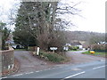
Coal tax post, Chipstead
The short white post in this image is a Coal Tax Post, one of a number which survive near or around the fringes of Greater London.
Image: © Malc McDonald
Taken: 11 Jan 2020
0.11 miles

10
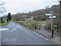
Outwood Lane, Chipstead
A view along Outwood Lane as the road heads out of the village of Chipstead towards Chipstead Bottom.
Image: © Malc McDonald
Taken: 11 Jan 2020
0.13 miles