
IMAGES TAKEN NEAR TO
Outwood Lane, COULSDON, CR5 3NG
Introduction
This page details the photographs taken nearby to Outwood Lane, CR5 3NG by members of the Geograph project.
The Geograph project started in 2005 with the aim of publishing, organising and preserving representative images for every square kilometre of Great Britain, Ireland and the Isle of Man.

There are currently over 7.5m images from over14,400 individuals and you can help contribute to the project by visiting https://www.geograph.org.uk
Image Map
Images are licensed for reuse under creativecommons.org/licenses/by-sa/2.0
Notes
- Clicking on the map will re-center to the selected point.
- The higher the marker number, the further away the image location is from the centre of the postcode.
Image Listing (61 Images Found)
Images are licensed for reuse under creativecommons.org/licenses/by-sa/2.0
Image
Details
Distance
1
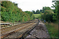
The Tattenham Corner branch in Chipstead Bottom
Viewed from the footpath level crossing, the line winds its way down the valley.
Image: © Robin Webster
Taken: 6 Oct 2010
0.03 miles
2
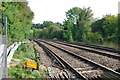
The Tattenham Corner branch in Chipstead Bottom
Viewed from the footpath level crossing, the line winds its way down the valley.
Image: © Robin Webster
Taken: 6 Oct 2010
0.03 miles
3

Chipstead: Outwood Lane
Looking east (towards Coulsdon). A layby has been provided for parking cars.
Image: © Dr Neil Clifton
Taken: 23 Sep 2014
0.03 miles
4

Railway through Chipstead Bottom
The railway through Chipstead Bottom, between Kingswood and Chipstead stations, viewed from the foot crossing below Fames Rough. The Tattenham Corner branch was built by the South Eastern Railway, whose chairman, Sir Cosmo Bonsor, lived in Kingswood Warren, with the section to Kingswood station opening in 1897 and the extension on to Tattenham Corner, serving Epsom Downs racecourse, following in 1901. In the background is a Class 377 on the 17:50 Tattenham Corner to London Bridge service.
Image: © Ian Capper
Taken: 5 Aug 2018
0.03 miles
5
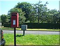
Post Box
Post Box CR5 23. Outwood Lane.
Image: © The Saunterer
Taken: 24 Jul 2012
0.03 miles

7

Footpath Junction
Junction of footpaths on Outwood Lane. FP60 south and FP?? east.
Image: © The Saunterer
Taken: 24 Jul 2012
0.03 miles
8

View along Footpath FP??
Footpath number on Surrey County Council Interactive is inconclusive!
Image: © The Saunterer
Taken: 24 Jul 2012
0.04 miles

10
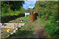
Path up to the downs
The path from Outwood Lane via a foot crossing of the railway.
Image: © Robin Webster
Taken: 6 Oct 2010
0.05 miles